
IDI Anogia, Greece - Earthquake Result Viewer
| ||||||||||||||||||
| ||||||||||||||||||
| ||||||||||||||||||
|
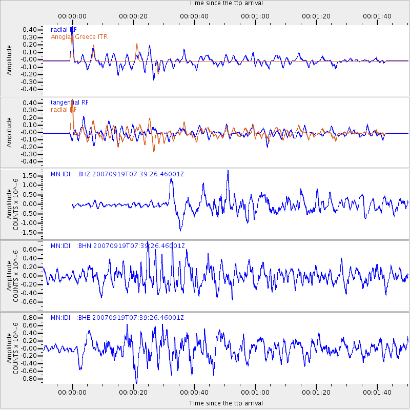
Signal To Noise
| Channel | StoN | STA | LTA |
| MN:IDI: :BHN:20070919T07:39:26.46001Z | 1.0706897 | 8.6444324E-8 | 8.073705E-8 |
| MN:IDI: :BHE:20070919T07:39:26.46001Z | 3.6561291 | 2.5126948E-7 | 6.872555E-8 |
| MN:IDI: :BHZ:20070919T07:39:26.46001Z | 8.102867 | 6.046345E-7 | 7.461983E-8 |
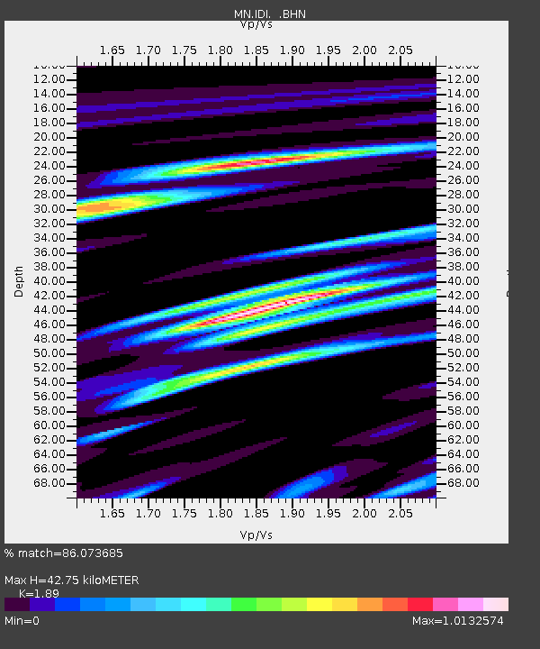
| Arrivals | |
| Ps | 6.9 SECOND |
| PpPs | 22 SECOND |
| PsPs/PpSs | 28 SECOND |

