IDI Anogia, Greece - Earthquake Result Viewer
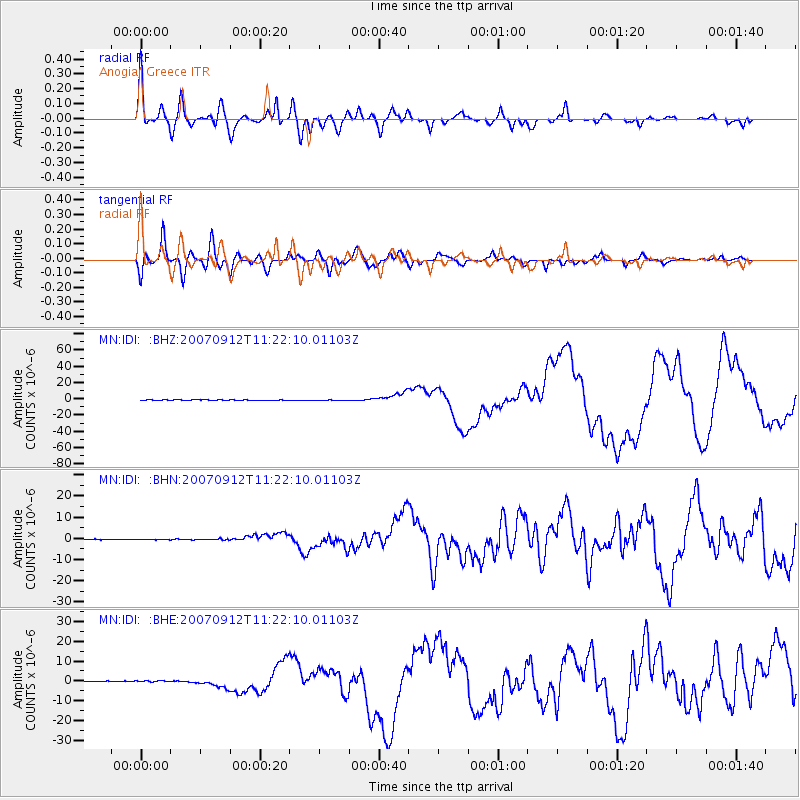
Earthquake location: Southern Sumatra, Indonesia
Earthquake latitude/longitude: -4.4/101.4
Earthquake time(UTC): 2007/09/12 (255) 11:10:26 GMT
Earthquake Depth: 34 km
Earthquake Magnitude: 6.9 MB, 8.5 MS, 8.4 MW, 8.0 ME
Earthquake Catalog/Contributor: WHDF/NEIC
Network: MN MEDNET Project
Station: IDI Anogia, Greece
Lat/Lon: 35.29 N/24.89 E
Elevation: 750 m
Distance: 81.6 deg
Az: 306.478 deg
Baz: 101.485 deg
Ray Param: 0.047443673
Estimated Moho Depth: 43.25 km
Estimated Crust Vp/Vs: 1.88
Assumed Crust Vp: 5.627 km/s
Estimated Crust Vs: 3.001 km/s
Estimated Crust Poisson's Ratio: 0.30
Radial Match: 93.76637 %
Radial Bump: 400
Transverse Match: 92.60895 %
Transverse Bump: 400
SOD ConfigId: 2564
Insert Time: 2010-03-08 17:09:47.322 +0000
GWidth: 2.5
Max Bumps: 400
Tol: 0.001

Signal To Noise

ChannelStoNSTALTA
MN:IDI: :BHN:20070912T11:22:10.01103Z1.18791062.1567075E-71.815547E-7
MN:IDI: :BHE:20070912T11:22:10.01103Z2.64536023.7909388E-71.433052E-7
MN:IDI: :BHZ:20070912T11:22:10.01103Z2.5825125.4251046E-72.1007084E-7
Arrivals
Ps6.9 SECOND
PpPs22 SECOND
PsPs/PpSs29 SECOND