IDI Anogia, Greece - Earthquake Result Viewer
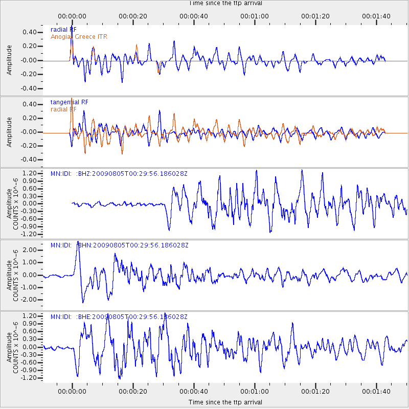
Earthquake location: Southwestern Ryukyu Isl., Japan
Earthquake latitude/longitude: 24.2/125.1
Earthquake time(UTC): 2009/08/05 (217) 00:17:58 GMT
Earthquake Depth: 25 km
Earthquake Magnitude: 5.9 MB, 5.9 MS, 6.2 MW, 6.1 MW
Earthquake Catalog/Contributor: WHDF/NEIC
Network: MN MEDNET Project
Station: IDI Anogia, Greece
Lat/Lon: 35.29 N/24.89 E
Elevation: 750 m
Distance: 84.1 deg
Az: 305.963 deg
Baz: 64.584 deg
Ray Param: 0.045677844
Estimated Moho Depth: 66.0 km
Estimated Crust Vp/Vs: 1.91
Assumed Crust Vp: 5.627 km/s
Estimated Crust Vs: 2.946 km/s
Estimated Crust Poisson's Ratio: 0.31
Radial Match: 83.17902 %
Radial Bump: 400
Transverse Match: 89.847946 %
Transverse Bump: 400
SOD ConfigId: 2622
Insert Time: 2010-03-08 17:10:01.306 +0000
GWidth: 2.5
Max Bumps: 400
Tol: 0.001

Signal To Noise

ChannelStoNSTALTA
MN:IDI: :BHN:20090805T00:29:56.186028Z21.9247761.4114263E-66.437586E-8
MN:IDI: :BHE:20090805T00:29:56.186028Z8.4208015.667724E-76.730623E-8
MN:IDI: :BHZ:20090805T00:29:56.186028Z10.3549214.8406065E-74.6746916E-8
Arrivals
Ps11 SECOND
PpPs34 SECOND
PsPs/PpSs44 SECOND