
IDI Anogia, Greece - Earthquake Result Viewer
| ||||||||||||||||||
| ||||||||||||||||||
| ||||||||||||||||||
|
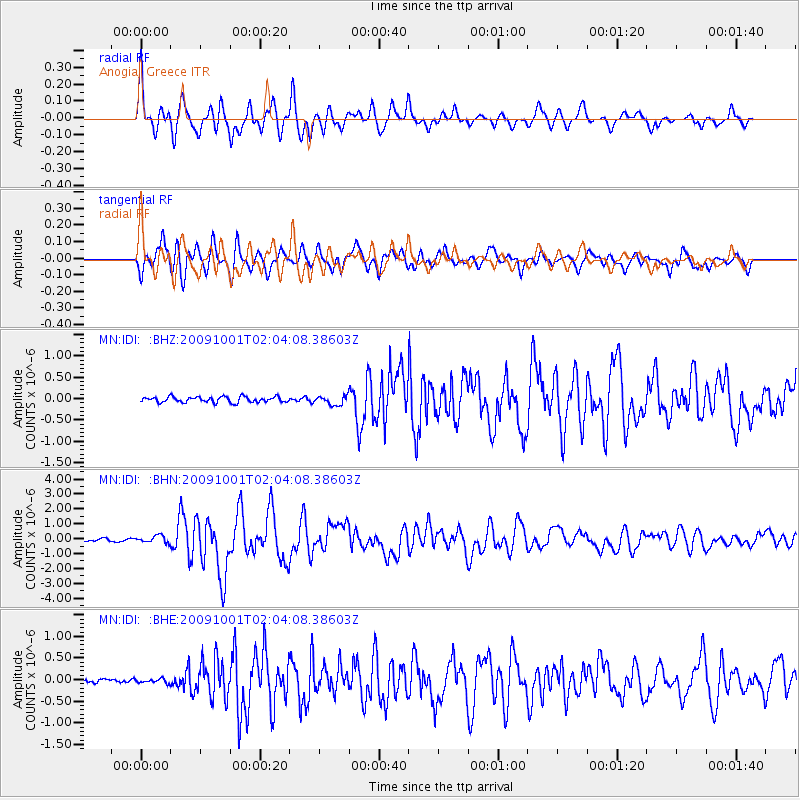
Signal To Noise
| Channel | StoN | STA | LTA |
| MN:IDI: :BHN:20091001T02:04:08.38603Z | 3.344788 | 2.4071971E-7 | 7.196861E-8 |
| MN:IDI: :BHE:20091001T02:04:08.38603Z | 0.88843596 | 4.764626E-8 | 5.362937E-8 |
| MN:IDI: :BHZ:20091001T02:04:08.38603Z | 1.6011629 | 1.0514355E-7 | 6.566699E-8 |
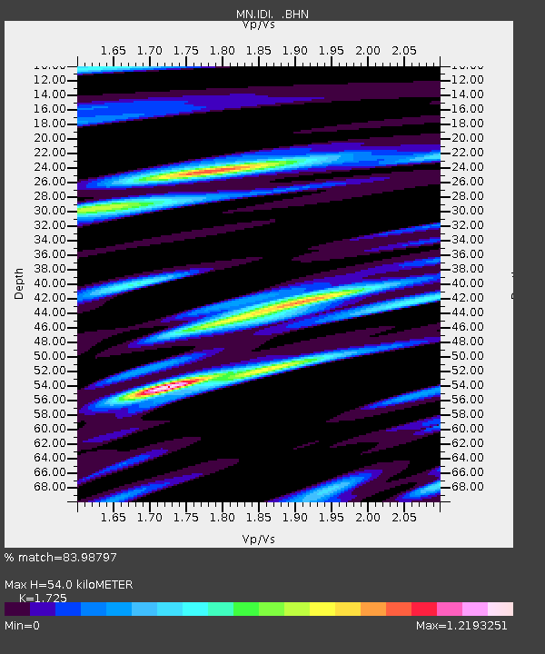
| Arrivals | |
| Ps | 7.1 SECOND |
| PpPs | 26 SECOND |
| PsPs/PpSs | 33 SECOND |

