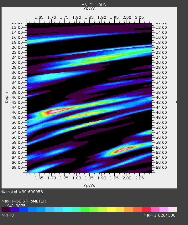
IDI Anogia, Greece - Earthquake Result Viewer
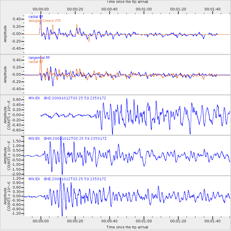
Earthquake location: Mauritius - Reunion Region
Earthquake latitude/longitude: -17.1/66.7
Earthquake time(UTC): 2009/10/12 (285) 03:15:47 GMT
Earthquake Depth: 10 km
Earthquake Magnitude: 6.2 MB, 6.0 MS, 6.2 MW, 6.1 MW
Earthquake Catalog/Contributor: WHDF/NEIC
Network: MN MEDNET Project
Station: IDI Anogia, Greece
Lat/Lon: 35.29 N/24.89 E
Elevation: 750 m
Distance: 65.5 deg
Az: 323.176 deg
Baz: 135.52 deg
Ray Param: 0.05825211
Estimated Moho Depth: 60.5 km
Estimated Crust Vp/Vs: 1.99
Assumed Crust Vp: 5.627 km/s
Estimated Crust Vs: 2.831 km/s
Estimated Crust Poisson's Ratio: 0.33
Radial Match: 89.608955 %
Radial Bump: 400
Transverse Match: 87.83696 %
Transverse Bump: 400
SOD ConfigId: 2622
Insert Time: 2010-03-08 17:10:07.825 +0000
GWidth: 2.5
Max Bumps: 400
Tol: 0.001

Signal To Noise

ChannelStoNSTALTA
MN:IDI: :BHN:20091012T03:25:59.235017Z3.75593353.160155E-78.4137675E-8
MN:IDI: :BHE:20091012T03:25:59.235017Z2.48424038.625808E-83.4722117E-8
MN:IDI: :BHZ:20091012T03:25:59.235017Z2.00369728.675101E-84.3295472E-8
Arrivals
Ps11 SECOND
PpPs31 SECOND
PsPs/PpSs42 SECOND