You are here: Home > Network List > TA - USArray Transportable Network (new EarthScope stations) Stations List
> Station R33M Jennings River, BC, CAN > Earthquake Result Viewer
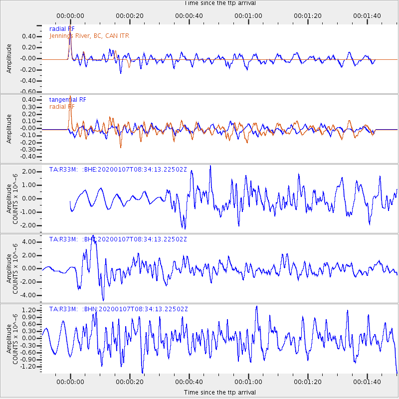
R33M Jennings River, BC, CAN - Earthquake Result Viewer
*The percent match for this event was below the threshold and hence no stack was calculated.
| Earthquake location: |
Puerto Rico Region |
| Earthquake latitude/longitude: |
17.9/-66.8 |
| Earthquake time(UTC): |
2020/01/07 (007) 08:24:26 GMT |
| Earthquake Depth: |
10 km |
| Earthquake Magnitude: |
6.4 mww |
| Earthquake Catalog/Contributor: |
NEIC PDE/us |
|
| Network: |
TA USArray Transportable Network (new EarthScope stations) |
| Station: |
R33M Jennings River, BC, CAN |
| Lat/Lon: |
59.39 N/130.97 W |
| Elevation: |
1437 m |
|
| Distance: |
61.6 deg |
| Az: |
328.446 deg |
| Baz: |
103.149 deg |
| Ray Param: |
$rayparam |
*The percent match for this event was below the threshold and hence was not used in the summary stack. |
|
| Radial Match: |
75.610054 % |
| Radial Bump: |
400 |
| Transverse Match: |
66.22878 % |
| Transverse Bump: |
400 |
| SOD ConfigId: |
20465011 |
| Insert Time: |
2020-01-21 08:48:02.758 +0000 |
| GWidth: |
2.5 |
| Max Bumps: |
400 |
| Tol: |
0.001 |
|
Signal To Noise
| Channel | StoN | STA | LTA |
| TA:R33M: :BHZ:20200107T08:34:13.22502Z | 6.007882 | 1.5158788E-6 | 2.52315E-7 |
| TA:R33M: :BHN:20200107T08:34:13.22502Z | 1.4166125 | 4.1346044E-7 | 2.918656E-7 |
| TA:R33M: :BHE:20200107T08:34:13.22502Z | 0.8656915 | 3.6749384E-7 | 4.24509E-7 |
| Arrivals |
| Ps | |
| PpPs | |
| PsPs/PpSs | |


