You are here: Home > Network List > US - United States National Seismic Network Stations List
> Station HAWA Hanford, Washington, USA > Earthquake Result Viewer
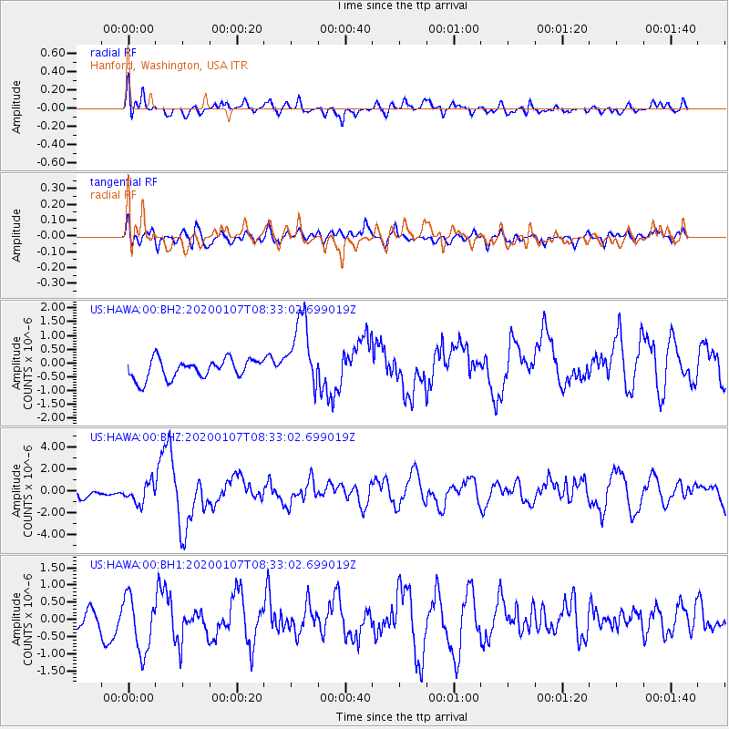
HAWA Hanford, Washington, USA - Earthquake Result Viewer
*The percent match for this event was below the threshold and hence no stack was calculated.
| Earthquake location: |
Puerto Rico Region |
| Earthquake latitude/longitude: |
17.9/-66.8 |
| Earthquake time(UTC): |
2020/01/07 (007) 08:24:26 GMT |
| Earthquake Depth: |
10 km |
| Earthquake Magnitude: |
6.4 mww |
| Earthquake Catalog/Contributor: |
NEIC PDE/us |
|
| Network: |
US United States National Seismic Network |
| Station: |
HAWA Hanford, Washington, USA |
| Lat/Lon: |
46.39 N/119.53 W |
| Elevation: |
364 m |
|
| Distance: |
51.7 deg |
| Az: |
315.428 deg |
| Baz: |
105.114 deg |
| Ray Param: |
$rayparam |
*The percent match for this event was below the threshold and hence was not used in the summary stack. |
|
| Radial Match: |
58.27579 % |
| Radial Bump: |
400 |
| Transverse Match: |
48.70414 % |
| Transverse Bump: |
400 |
| SOD ConfigId: |
20465011 |
| Insert Time: |
2020-01-21 08:50:37.364 +0000 |
| GWidth: |
2.5 |
| Max Bumps: |
400 |
| Tol: |
0.001 |
|
Signal To Noise
| Channel | StoN | STA | LTA |
| US:HAWA:00:BHZ:20200107T08:33:02.699019Z | 1.89824 | 9.4097527E-7 | 4.9570934E-7 |
| US:HAWA:00:BH1:20200107T08:33:02.699019Z | 2.6615508 | 8.299065E-7 | 3.1181315E-7 |
| US:HAWA:00:BH2:20200107T08:33:02.699019Z | 3.7386317 | 1.3042991E-6 | 3.488707E-7 |
| Arrivals |
| Ps | |
| PpPs | |
| PsPs/PpSs | |


