You are here: Home > Network List > AV - Alaska Volcano Observatory Stations List
> Station SPCR Ckakachatna River, Mount Spurr, Alaska > Earthquake Result Viewer
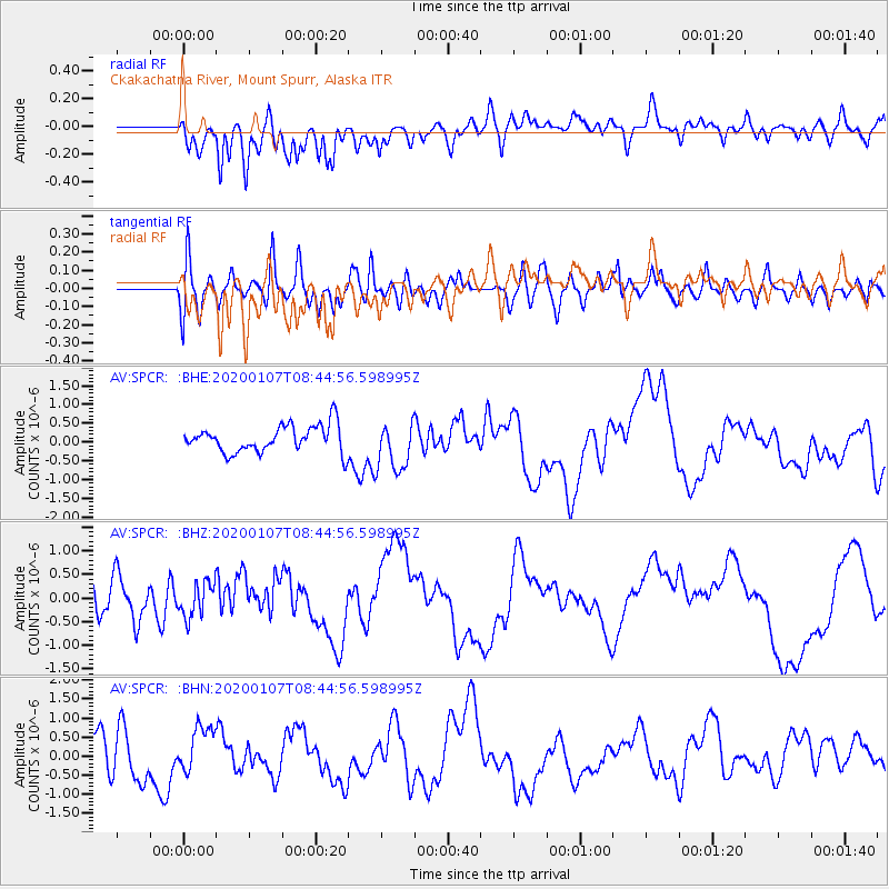
SPCR Ckakachatna River, Mount Spurr, Alaska - Earthquake Result Viewer
*The percent match for this event was below the threshold and hence no stack was calculated.
| Earthquake location: |
Puerto Rico Region |
| Earthquake latitude/longitude: |
17.9/-66.7 |
| Earthquake time(UTC): |
2020/01/07 (007) 08:34:02 GMT |
| Earthquake Depth: |
10 km |
| Earthquake Magnitude: |
5.6 Mww |
| Earthquake Catalog/Contributor: |
NEIC PDE/us |
|
| Network: |
AV Alaska Volcano Observatory |
| Station: |
SPCR Ckakachatna River, Mount Spurr, Alaska |
| Lat/Lon: |
61.20 N/152.21 W |
| Elevation: |
984 m |
|
| Distance: |
72.3 deg |
| Az: |
329.556 deg |
| Baz: |
85.036 deg |
| Ray Param: |
$rayparam |
*The percent match for this event was below the threshold and hence was not used in the summary stack. |
|
| Radial Match: |
40.892845 % |
| Radial Bump: |
400 |
| Transverse Match: |
35.389183 % |
| Transverse Bump: |
400 |
| SOD ConfigId: |
20465011 |
| Insert Time: |
2020-01-21 08:57:05.799 +0000 |
| GWidth: |
2.5 |
| Max Bumps: |
400 |
| Tol: |
0.001 |
|
Signal To Noise
| Channel | StoN | STA | LTA |
| AV:SPCR: :BHZ:20200107T08:44:56.598995Z | 0.87531626 | 3.7046672E-7 | 4.2323757E-7 |
| AV:SPCR: :BHN:20200107T08:44:56.598995Z | 1.3238584 | 6.1610723E-7 | 4.6538756E-7 |
| AV:SPCR: :BHE:20200107T08:44:56.598995Z | 1.8187524 | 6.506848E-7 | 3.5776438E-7 |
| Arrivals |
| Ps | |
| PpPs | |
| PsPs/PpSs | |


