You are here: Home > Network List > TA - USArray Transportable Network (new EarthScope stations) Stations List
> Station E18K Tukpahlearik Creek, AK, USA > Earthquake Result Viewer
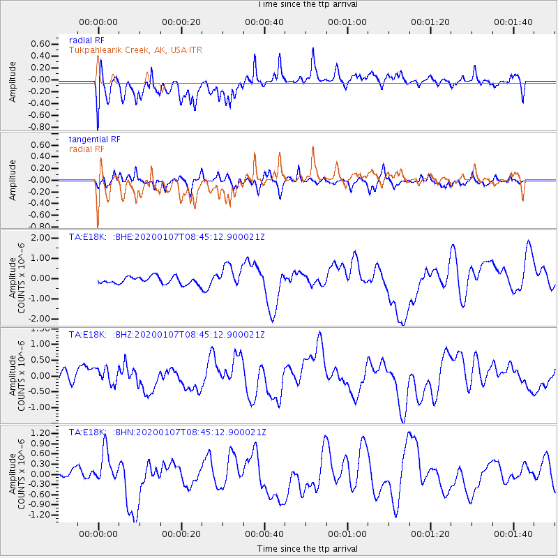
E18K Tukpahlearik Creek, AK, USA - Earthquake Result Viewer
*The percent match for this event was below the threshold and hence no stack was calculated.
| Earthquake location: |
Puerto Rico Region |
| Earthquake latitude/longitude: |
17.9/-66.7 |
| Earthquake time(UTC): |
2020/01/07 (007) 08:34:02 GMT |
| Earthquake Depth: |
10 km |
| Earthquake Magnitude: |
5.6 Mww |
| Earthquake Catalog/Contributor: |
NEIC PDE/us |
|
| Network: |
TA USArray Transportable Network (new EarthScope stations) |
| Station: |
E18K Tukpahlearik Creek, AK, USA |
| Lat/Lon: |
67.42 N/160.60 W |
| Elevation: |
297 m |
|
| Distance: |
75.1 deg |
| Az: |
336.503 deg |
| Baz: |
79.421 deg |
| Ray Param: |
$rayparam |
*The percent match for this event was below the threshold and hence was not used in the summary stack. |
|
| Radial Match: |
53.892273 % |
| Radial Bump: |
400 |
| Transverse Match: |
55.510857 % |
| Transverse Bump: |
400 |
| SOD ConfigId: |
20465011 |
| Insert Time: |
2020-01-21 09:07:05.854 +0000 |
| GWidth: |
2.5 |
| Max Bumps: |
400 |
| Tol: |
0.001 |
|
Signal To Noise
| Channel | StoN | STA | LTA |
| TA:E18K: :BHZ:20200107T08:45:12.900021Z | 0.7322228 | 2.477506E-7 | 3.3835408E-7 |
| TA:E18K: :BHN:20200107T08:45:12.900021Z | 2.9489932 | 5.204938E-7 | 1.7649882E-7 |
| TA:E18K: :BHE:20200107T08:45:12.900021Z | 3.2980683 | 5.8515474E-7 | 1.7742349E-7 |
| Arrivals |
| Ps | |
| PpPs | |
| PsPs/PpSs | |


