
KEG Kottamya, Egypt - Earthquake Result Viewer
| ||||||||||||||||||
| ||||||||||||||||||
| ||||||||||||||||||
|
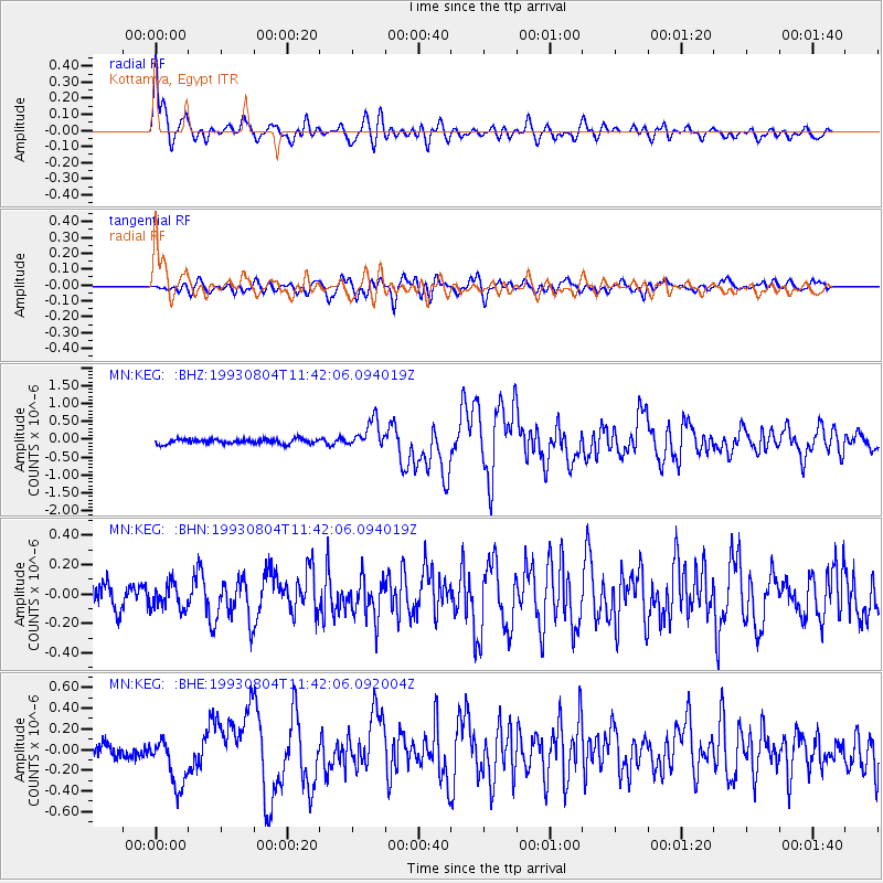
Signal To Noise
| Channel | StoN | STA | LTA |
| MN:KEG: :BHN:19930804T11:42:06.094019Z | 1.0220994 | 8.615614E-8 | 8.429331E-8 |
| MN:KEG: :BHE:19930804T11:42:06.092004Z | 2.7380836 | 2.4726475E-7 | 9.0305775E-8 |
| MN:KEG: :BHZ:19930804T11:42:06.094019Z | 5.641915 | 3.875623E-7 | 6.8693396E-8 |
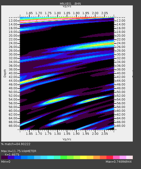
| Arrivals | |
| Ps | 1.3 SECOND |
| PpPs | 4.8 SECOND |
| PsPs/PpSs | 6.2 SECOND |

