You are here: Home > Network List > CN - Canadian National Seismograph Network Stations List
> Station INK INUVIK, NT > Earthquake Result Viewer
INK INUVIK, NT - Earthquake Result Viewer
*The percent match for this event was below the threshold and hence no stack was calculated.
| Earthquake location: |
Puerto Rico Region |
| Earthquake latitude/longitude: |
18.0/-66.8 |
| Earthquake time(UTC): |
2020/01/07 (007) 11:18:17 GMT |
| Earthquake Depth: |
5.0 km |
| Earthquake Magnitude: |
6.0 Mi |
| Earthquake Catalog/Contributor: |
NEIC PDE/pt |
|
| Network: |
CN Canadian National Seismograph Network |
| Station: |
INK INUVIK, NT |
| Lat/Lon: |
68.31 N/133.53 W |
| Elevation: |
44 m |
|
| Distance: |
64.9 deg |
| Az: |
337.841 deg |
| Baz: |
105.071 deg |
| Ray Param: |
$rayparam |
*The percent match for this event was below the threshold and hence was not used in the summary stack. |
|
| Radial Match: |
69.01832 % |
| Radial Bump: |
400 |
| Transverse Match: |
78.772156 % |
| Transverse Bump: |
400 |
| SOD ConfigId: |
20465011 |
| Insert Time: |
2020-01-21 11:23:07.558 +0000 |
| GWidth: |
2.5 |
| Max Bumps: |
400 |
| Tol: |
0.001 |
|
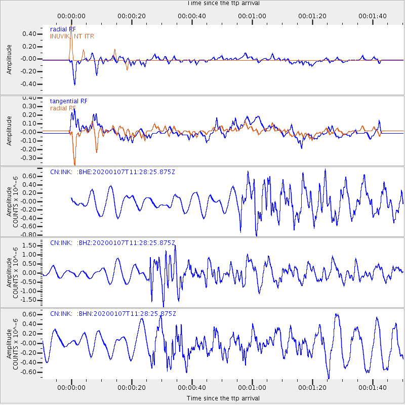
Signal To Noise
| Channel | StoN | STA | LTA |
| CN:INK: :BHZ:20200107T11:28:25.875Z | 0.28527093 | 1.03656824E-7 | 3.6336272E-7 |
| CN:INK: :BHN:20200107T11:28:25.875Z | 0.6890654 | 2.2660949E-7 | 3.28865E-7 |
| CN:INK: :BHE:20200107T11:28:25.875Z | 0.54150367 | 1.00216965E-7 | 1.8507163E-7 |
| Arrivals |
| Ps | |
| PpPs | |
| PsPs/PpSs | |


