You are here: Home > Network List > TA - USArray Transportable Network (new EarthScope stations) Stations List
> Station H31M Peel River, Yukon, CAN > Earthquake Result Viewer
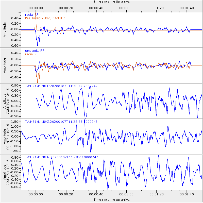
H31M Peel River, Yukon, CAN - Earthquake Result Viewer
*The percent match for this event was below the threshold and hence no stack was calculated.
| Earthquake location: |
Puerto Rico Region |
| Earthquake latitude/longitude: |
18.0/-66.8 |
| Earthquake time(UTC): |
2020/01/07 (007) 11:18:17 GMT |
| Earthquake Depth: |
5.0 km |
| Earthquake Magnitude: |
6.0 Mi |
| Earthquake Catalog/Contributor: |
NEIC PDE/pt |
|
| Network: |
TA USArray Transportable Network (new EarthScope stations) |
| Station: |
H31M Peel River, Yukon, CAN |
| Lat/Lon: |
65.81 N/134.34 W |
| Elevation: |
642 m |
|
| Distance: |
64.6 deg |
| Az: |
335.059 deg |
| Baz: |
103.13 deg |
| Ray Param: |
$rayparam |
*The percent match for this event was below the threshold and hence was not used in the summary stack. |
|
| Radial Match: |
55.69064 % |
| Radial Bump: |
393 |
| Transverse Match: |
52.021168 % |
| Transverse Bump: |
385 |
| SOD ConfigId: |
20465011 |
| Insert Time: |
2020-01-21 11:28:32.660 +0000 |
| GWidth: |
2.5 |
| Max Bumps: |
400 |
| Tol: |
0.001 |
|
Signal To Noise
| Channel | StoN | STA | LTA |
| TA:H31M: :BHZ:20200107T11:28:23.900024Z | 0.8057165 | 2.73689E-7 | 3.3968402E-7 |
| TA:H31M: :BHN:20200107T11:28:23.900024Z | 0.7484098 | 2.7311924E-7 | 3.6493273E-7 |
| TA:H31M: :BHE:20200107T11:28:23.900024Z | 2.0921056 | 6.6149346E-7 | 3.161855E-7 |
| Arrivals |
| Ps | |
| PpPs | |
| PsPs/PpSs | |


