You are here: Home > Network List > US - United States National Seismic Network Stations List
> Station DUG Dugway, Tooele County, Utah, USA > Earthquake Result Viewer
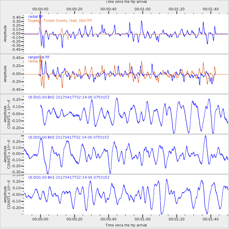
DUG Dugway, Tooele County, Utah, USA - Earthquake Result Viewer
*The percent match for this event was below the threshold and hence no stack was calculated.
| Earthquake location: |
Vanuatu Islands |
| Earthquake latitude/longitude: |
-13.4/166.5 |
| Earthquake time(UTC): |
2017/04/17 (107) 02:21:32 GMT |
| Earthquake Depth: |
20 km |
| Earthquake Magnitude: |
5.7 Mww |
| Earthquake Catalog/Contributor: |
NEIC PDE/us |
|
| Network: |
US United States National Seismic Network |
| Station: |
DUG Dugway, Tooele County, Utah, USA |
| Lat/Lon: |
40.19 N/112.81 W |
| Elevation: |
1477 m |
|
| Distance: |
91.5 deg |
| Az: |
49.12 deg |
| Baz: |
253.861 deg |
| Ray Param: |
$rayparam |
*The percent match for this event was below the threshold and hence was not used in the summary stack. |
|
| Radial Match: |
69.88946 % |
| Radial Bump: |
400 |
| Transverse Match: |
56.339214 % |
| Transverse Bump: |
350 |
| SOD ConfigId: |
2028011 |
| Insert Time: |
2017-05-01 02:24:02.032 +0000 |
| GWidth: |
2.5 |
| Max Bumps: |
400 |
| Tol: |
0.001 |
|
Signal To Noise
| Channel | StoN | STA | LTA |
| US:DUG:00:BHZ:20170417T02:34:06.075015Z | 2.2573752 | 2.0918131E-7 | 9.266572E-8 |
| US:DUG:00:BH1:20170417T02:34:06.075015Z | 0.7678302 | 5.2791037E-8 | 6.8753536E-8 |
| US:DUG:00:BH2:20170417T02:34:06.075015Z | 2.315079 | 1.2552788E-7 | 5.4221854E-8 |
| Arrivals |
| Ps | |
| PpPs | |
| PsPs/PpSs | |


