
KEG Kottamya, Egypt - Earthquake Result Viewer
| ||||||||||||||||||
| ||||||||||||||||||
| ||||||||||||||||||
|
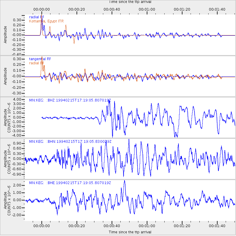
Signal To Noise
| Channel | StoN | STA | LTA |
| MN:KEG: :BHN:19940215T17:19:05.830029Z | 1.6107198 | 1.4461399E-7 | 8.978222E-8 |
| MN:KEG: :BHE:19940215T17:19:05.807019Z | 1.4796543 | 1.7966175E-7 | 1.2142144E-7 |
| MN:KEG: :BHZ:19940215T17:19:05.807019Z | 6.9448223 | 7.5290217E-7 | 1.0841201E-7 |
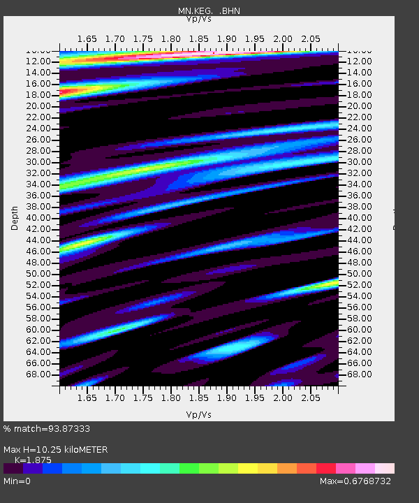
| Arrivals | |
| Ps | 1.5 SECOND |
| PpPs | 4.5 SECOND |
| PsPs/PpSs | 6.0 SECOND |

