KEG Kottamya, Egypt - Earthquake Result Viewer
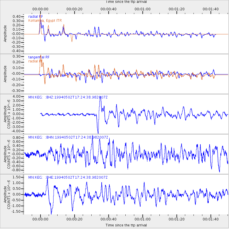
Earthquake location: Southwest Of Sumatra, Indonesia
Earthquake latitude/longitude: -1.1/97.6
Earthquake time(UTC): 1994/05/02 (122) 17:14:03 GMT
Earthquake Depth: 38 km
Earthquake Magnitude: 6.1 MB, 5.8 MS, 5.6 UNKNOWN, 6.0 MW
Earthquake Catalog/Contributor: WHDF/NEIC
Network: MN MEDNET Project
Station: KEG Kottamya, Egypt
Lat/Lon: 29.93 N/31.83 E
Elevation: 460 m
Distance: 69.7 deg
Az: 302.438 deg
Baz: 103.583 deg
Ray Param: 0.05539125
Estimated Moho Depth: 10.5 km
Estimated Crust Vp/Vs: 1.96
Assumed Crust Vp: 6.312 km/s
Estimated Crust Vs: 3.229 km/s
Estimated Crust Poisson's Ratio: 0.32
Radial Match: 92.00708 %
Radial Bump: 400
Transverse Match: 81.73352 %
Transverse Bump: 400
SOD ConfigId: 16938
Insert Time: 2010-03-08 17:13:10.562 +0000
GWidth: 2.5
Max Bumps: 400
Tol: 0.001

Signal To Noise

ChannelStoNSTALTA
MN:KEG: :BHN:19940502T17:24:38.982007Z1.04115131.03309446E-79.922616E-8
MN:KEG: :BHE:19940502T17:24:38.982007Z4.97375254.9202936E-79.892518E-8
MN:KEG: :BHZ:19940502T17:24:38.982007Z11.6454291.6051058E-61.378314E-7
Arrivals
Ps1.6 SECOND
PpPs4.8 SECOND
PsPs/PpSs6.4 SECOND