KEG Kottamya, Egypt - Earthquake Result Viewer
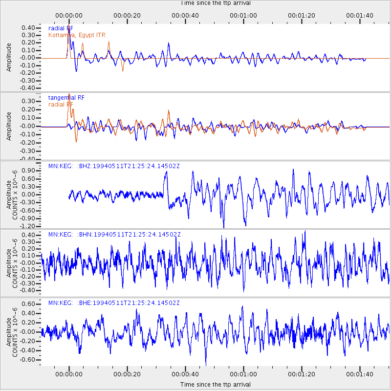
Earthquake location: Southern Sumatra, Indonesia
Earthquake latitude/longitude: -2.1/99.7
Earthquake time(UTC): 1994/05/11 (131) 21:14:34 GMT
Earthquake Depth: 28 km
Earthquake Magnitude: 5.8 MB, 5.8 MS, 5.8 UNKNOWN, 6.0 MW
Earthquake Catalog/Contributor: WHDF/NEIC
Network: MN MEDNET Project
Station: KEG Kottamya, Egypt
Lat/Lon: 29.93 N/31.83 E
Elevation: 460 m
Distance: 72.0 deg
Az: 302.265 deg
Baz: 103.234 deg
Ray Param: 0.05390266
Estimated Moho Depth: 10.75 km
Estimated Crust Vp/Vs: 1.81
Assumed Crust Vp: 6.312 km/s
Estimated Crust Vs: 3.492 km/s
Estimated Crust Poisson's Ratio: 0.28
Radial Match: 83.036156 %
Radial Bump: 400
Transverse Match: 64.47145 %
Transverse Bump: 400
SOD ConfigId: 16938
Insert Time: 2010-03-08 17:13:13.185 +0000
GWidth: 2.5
Max Bumps: 400
Tol: 0.001

Signal To Noise

ChannelStoNSTALTA
MN:KEG: :BHN:19940511T21:25:24.14502Z1.0405911.0329942E-79.926995E-8
MN:KEG: :BHE:19940511T21:25:24.14502Z1.70282961.7396626E-71.0216304E-7
MN:KEG: :BHZ:19940511T21:25:24.14502Z3.35196973.7773668E-71.12690955E-7
Arrivals
Ps1.4 SECOND
PpPs4.6 SECOND
PsPs/PpSs6.0 SECOND