
KEG Kottamya, Egypt - Earthquake Result Viewer
| ||||||||||||||||||
| ||||||||||||||||||
| ||||||||||||||||||
|
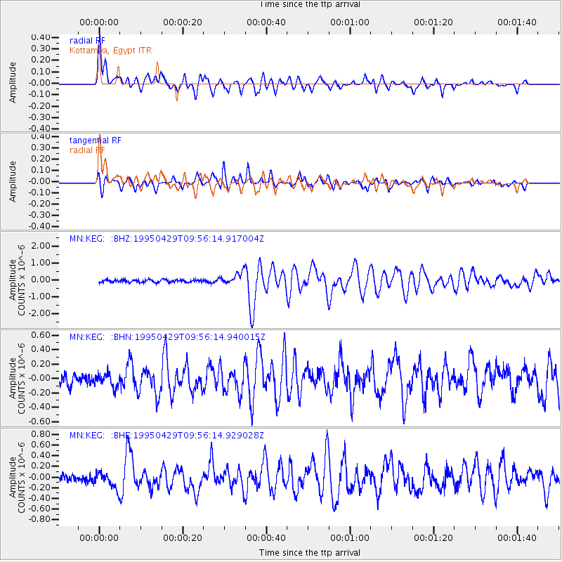
Signal To Noise
| Channel | StoN | STA | LTA |
| MN:KEG: :BHN:19950429T09:56:14.940015Z | 1.0706167 | 9.563616E-8 | 8.9328104E-8 |
| MN:KEG: :BHE:19950429T09:56:14.929028Z | 1.9633276 | 1.6033665E-7 | 8.166577E-8 |
| MN:KEG: :BHZ:19950429T09:56:14.917004Z | 4.7335773 | 3.5570523E-7 | 7.514512E-8 |
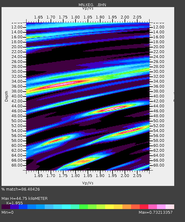
| Arrivals | |
| Ps | 6.9 SECOND |
| PpPs | 21 SECOND |
| PsPs/PpSs | 27 SECOND |

