KEG Kottamya, Egypt - Earthquake Result Viewer
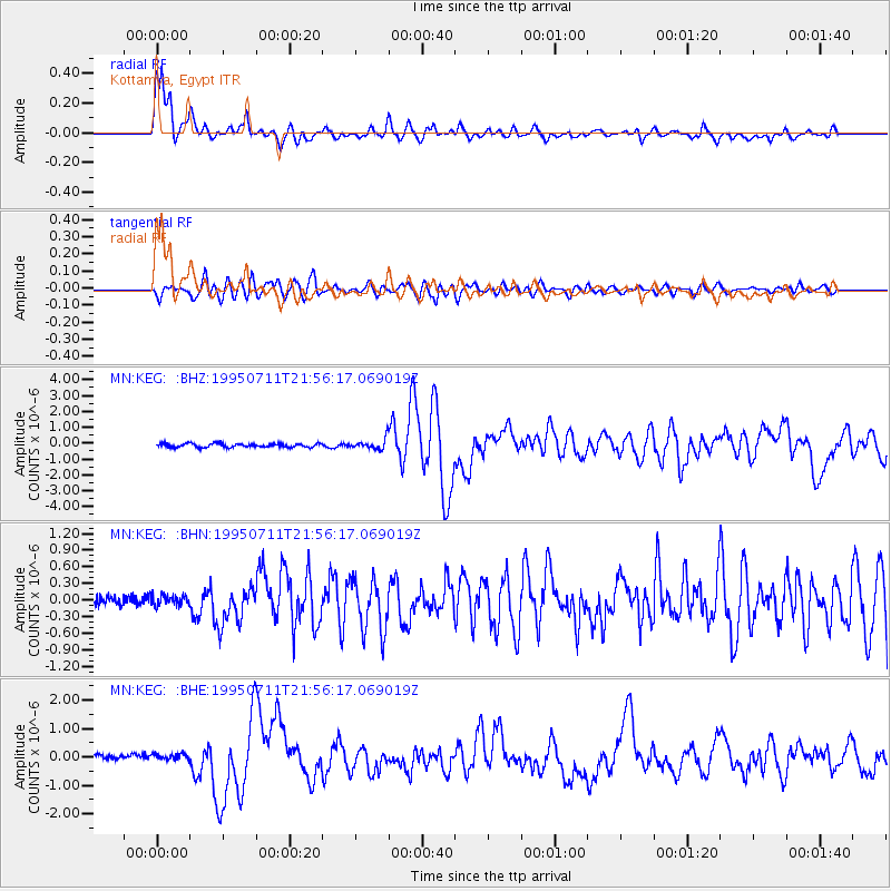
Earthquake location: Myanmar-China Border Region
Earthquake latitude/longitude: 21.9/99.2
Earthquake time(UTC): 1995/07/11 (192) 21:46:39 GMT
Earthquake Depth: 13 km
Earthquake Magnitude: 6.1 MB, 7.2 MS, 6.9 UNKNOWN, 6.8 MW
Earthquake Catalog/Contributor: WHDF/NEIC
Network: MN MEDNET Project
Station: KEG Kottamya, Egypt
Lat/Lon: 29.93 N/31.83 E
Elevation: 460 m
Distance: 60.3 deg
Az: 292.795 deg
Baz: 80.409 deg
Ray Param: 0.061595317
Estimated Moho Depth: 28.75 km
Estimated Crust Vp/Vs: 2.10
Assumed Crust Vp: 6.312 km/s
Estimated Crust Vs: 3.01 km/s
Estimated Crust Poisson's Ratio: 0.35
Radial Match: 91.32689 %
Radial Bump: 400
Transverse Match: 86.87096 %
Transverse Bump: 400
SOD ConfigId: 6273
Insert Time: 2010-03-08 17:14:15.800 +0000
GWidth: 2.5
Max Bumps: 400
Tol: 0.001

Signal To Noise

ChannelStoNSTALTA
MN:KEG: :BHN:19950711T21:56:17.069019Z1.13799949.3765316E-88.239488E-8
MN:KEG: :BHE:19950711T21:56:17.069019Z1.07402121.12526784E-71.04771466E-7
MN:KEG: :BHZ:19950711T21:56:17.069019Z2.78254493.2091435E-71.1533124E-7
Arrivals
Ps5.2 SECOND
PpPs14 SECOND
PsPs/PpSs19 SECOND