You are here: Home > Network List > TA - USArray Transportable Network (new EarthScope stations) Stations List
> Station E20K Nigu River, AK, USA > Earthquake Result Viewer
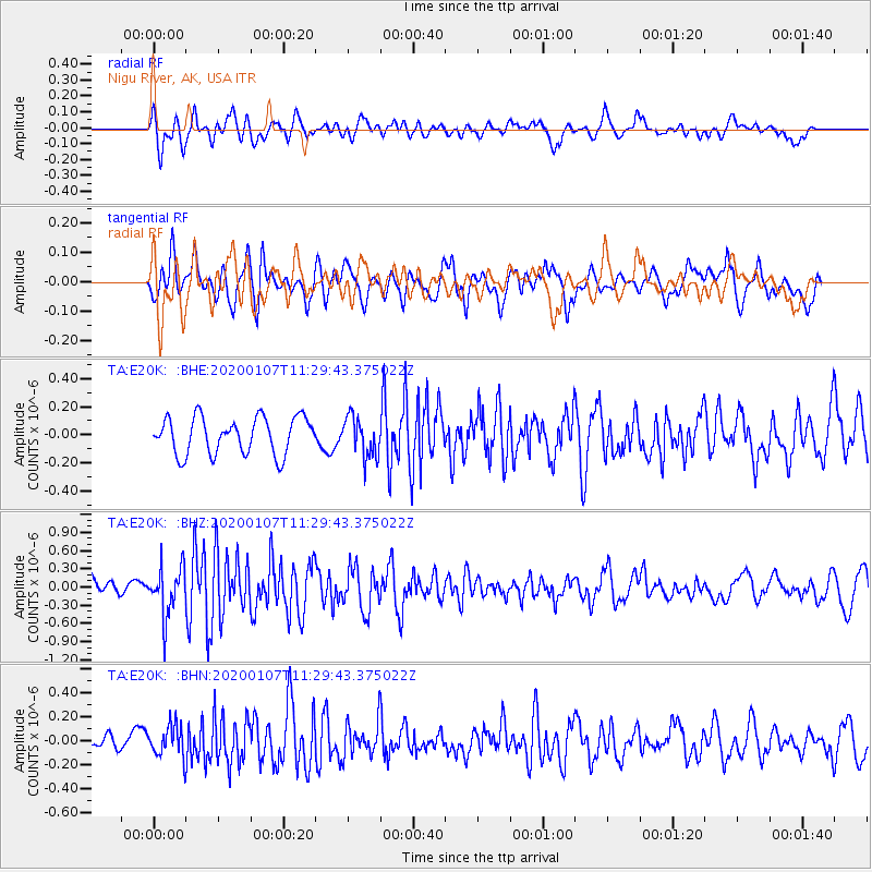
E20K Nigu River, AK, USA - Earthquake Result Viewer
*The percent match for this event was below the threshold and hence no stack was calculated.
| Earthquake location: |
Puerto Rico Region |
| Earthquake latitude/longitude: |
18.0/-66.8 |
| Earthquake time(UTC): |
2020/01/07 (007) 11:18:43 GMT |
| Earthquake Depth: |
9.0 km |
| Earthquake Magnitude: |
5.8 Mww |
| Earthquake Catalog/Contributor: |
NEIC PDE/pr |
|
| Network: |
TA USArray Transportable Network (new EarthScope stations) |
| Station: |
E20K Nigu River, AK, USA |
| Lat/Lon: |
68.26 N/156.19 W |
| Elevation: |
866 m |
|
| Distance: |
73.2 deg |
| Az: |
337.097 deg |
| Baz: |
83.672 deg |
| Ray Param: |
$rayparam |
*The percent match for this event was below the threshold and hence was not used in the summary stack. |
|
| Radial Match: |
62.13338 % |
| Radial Bump: |
400 |
| Transverse Match: |
63.82607 % |
| Transverse Bump: |
400 |
| SOD ConfigId: |
20465011 |
| Insert Time: |
2020-01-21 11:44:00.294 +0000 |
| GWidth: |
2.5 |
| Max Bumps: |
400 |
| Tol: |
0.001 |
|
Signal To Noise
| Channel | StoN | STA | LTA |
| TA:E20K: :BHZ:20200107T11:29:43.375022Z | 2.142504 | 4.0119437E-7 | 1.872549E-7 |
| TA:E20K: :BHN:20200107T11:29:43.375022Z | 1.4497052 | 1.3088543E-7 | 9.028417E-8 |
| TA:E20K: :BHE:20200107T11:29:43.375022Z | 1.087228 | 1.4179226E-7 | 1.3041631E-7 |
| Arrivals |
| Ps | |
| PpPs | |
| PsPs/PpSs | |


