KEG Kottamya, Egypt - Earthquake Result Viewer
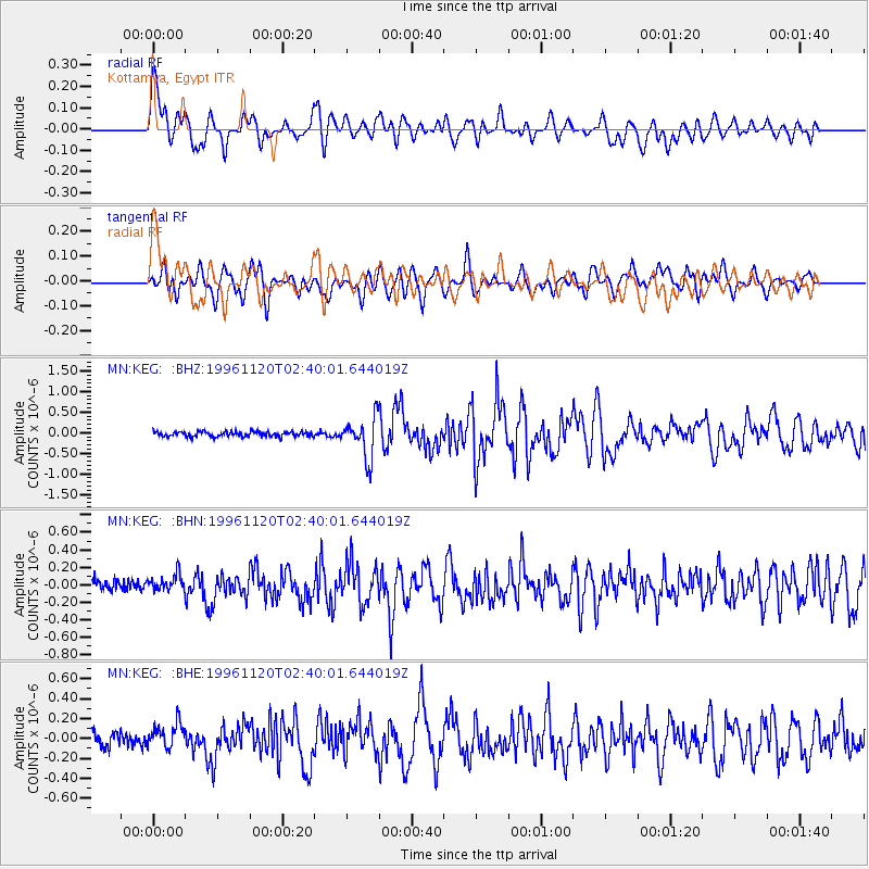
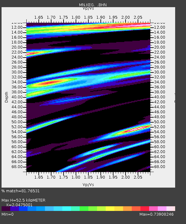
Earthquake location: Off East Coast Of Honshu, Japan
Earthquake latitude/longitude: 34.3/141.1
Earthquake time(UTC): 1996/11/20 (325) 02:27:47 GMT
Earthquake Depth: 33 km
Earthquake Magnitude: 5.9 MB, 5.7 MS, 6.1 UNKNOWN, 6.1 MW
Earthquake Catalog/Contributor: WHDF/NEIC
Network: MN MEDNET Project
Station: KEG Kottamya, Egypt
Lat/Lon: 29.93 N/31.83 E
Elevation: 460 m
Distance: 87.6 deg
Az: 304.915 deg
Baz: 51.4 deg
Ray Param: 0.043145567
Estimated Moho Depth: 52.5 km
Estimated Crust Vp/Vs: 2.05
Assumed Crust Vp: 6.312 km/s
Estimated Crust Vs: 3.083 km/s
Estimated Crust Poisson's Ratio: 0.34
Radial Match: 81.76531 %
Radial Bump: 400
Transverse Match: 78.18159 %
Transverse Bump: 400
SOD ConfigId: 6273
Insert Time: 2010-03-08 17:14:24.675 +0000
GWidth: 2.5
Max Bumps: 400
Tol: 0.001

Signal To Noise

ChannelStoNSTALTA
MN:KEG: :BHN:19961120T02:40:01.644019Z1.34504661.2315415E-79.156125E-8
MN:KEG: :BHE:19961120T02:40:01.644019Z1.89021841.2934332E-76.842772E-8
MN:KEG: :BHZ:19961120T02:40:01.644019Z8.0615334.844657E-76.009598E-8
Arrivals
Ps8.9 SECOND
PpPs25 SECOND
PsPs/PpSs34 SECOND