
KEG Kottamya, Egypt - Earthquake Result Viewer
| ||||||||||||||||||
| ||||||||||||||||||
| ||||||||||||||||||
|
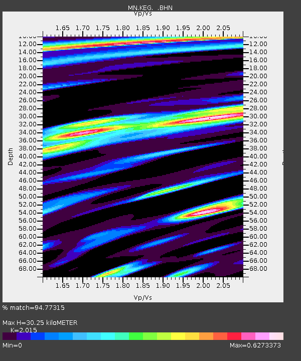
Signal To Noise
| Channel | StoN | STA | LTA |
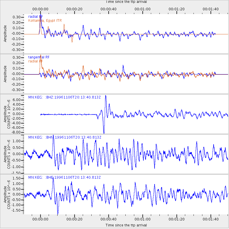
| MN:KEG: :BHN:19961106T20:13:40.813Z | 1.6437128 | 1.7595202E-7 | 1.0704548E-7 |
| MN:KEG: :BHE:19961106T20:13:40.813Z | 2.0986097 | 2.048501E-7 | 9.761229E-8 |
| MN:KEG: :BHZ:19961106T20:13:40.813Z | 6.482756 | 5.517408E-7 | 8.510899E-8 |
| Arrivals | |
| Ps | 4.9 SECOND |
| PpPs | 14 SECOND |
| PsPs/PpSs | 19 SECOND |

