
KEG Kottamya, Egypt - Earthquake Result Viewer
| ||||||||||||||||||
| ||||||||||||||||||
| ||||||||||||||||||
|
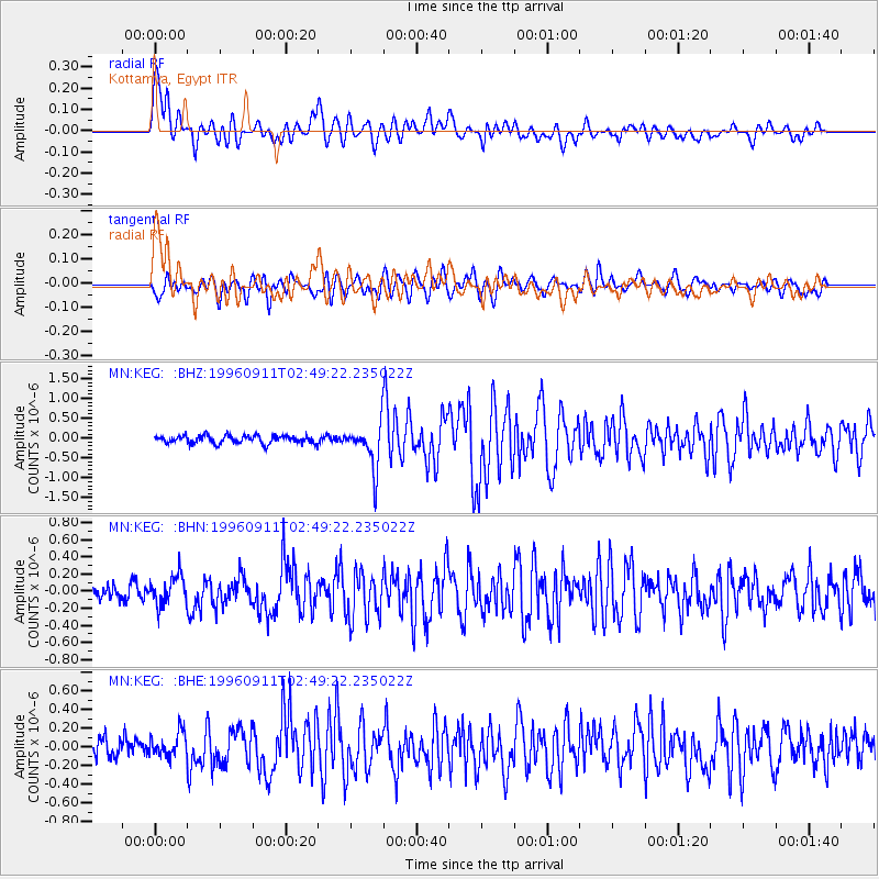
Signal To Noise
| Channel | StoN | STA | LTA |
| MN:KEG: :BHN:19960911T02:49:22.235022Z | 2.0869503 | 1.6854084E-7 | 8.0759385E-8 |
| MN:KEG: :BHE:19960911T02:49:22.235022Z | 1.4993529 | 1.3364226E-7 | 8.913329E-8 |
| MN:KEG: :BHZ:19960911T02:49:22.235022Z | 5.578659 | 5.556801E-7 | 9.960818E-8 |
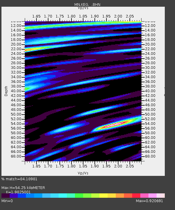
| Arrivals | |
| Ps | 8.6 SECOND |
| PpPs | 25 SECOND |
| PsPs/PpSs | 34 SECOND |

