You are here: Home > Network List > IU - Global Seismograph Network (GSN - IRIS/USGS) Stations List
> Station FURI Mt. Furi, Ethiopia > Earthquake Result Viewer
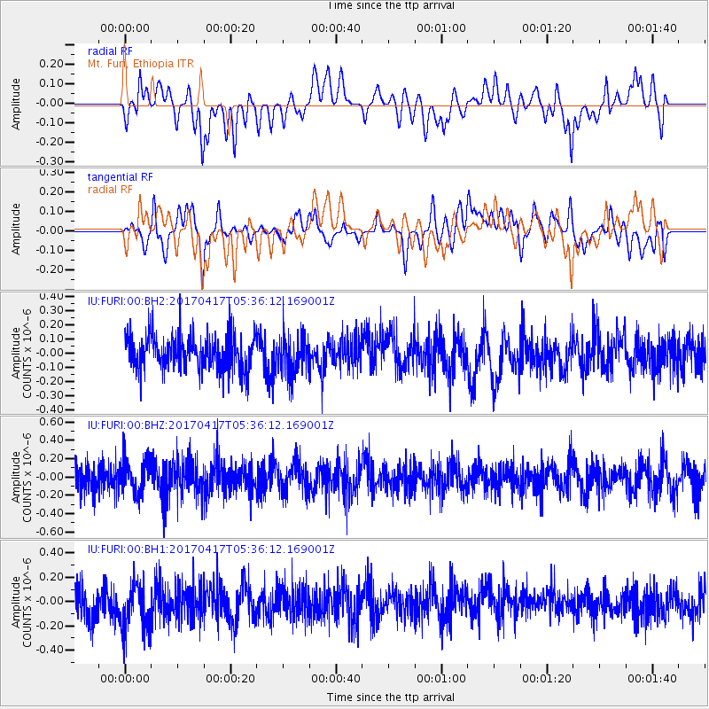
FURI Mt. Furi, Ethiopia - Earthquake Result Viewer
*The percent match for this event was below the threshold and hence no stack was calculated.
| Earthquake location: |
Leeward Islands |
| Earthquake latitude/longitude: |
17.5/-61.1 |
| Earthquake time(UTC): |
2017/04/17 (107) 05:23:15 GMT |
| Earthquake Depth: |
21 km |
| Earthquake Magnitude: |
5.6 Mww |
| Earthquake Catalog/Contributor: |
NEIC PDE/us |
|
| Network: |
IU Global Seismograph Network (GSN - IRIS/USGS) |
| Station: |
FURI Mt. Furi, Ethiopia |
| Lat/Lon: |
8.90 N/38.68 E |
| Elevation: |
2570 m |
|
| Distance: |
96.6 deg |
| Az: |
78.567 deg |
| Baz: |
288.788 deg |
| Ray Param: |
$rayparam |
*The percent match for this event was below the threshold and hence was not used in the summary stack. |
|
| Radial Match: |
47.27519 % |
| Radial Bump: |
400 |
| Transverse Match: |
34.971672 % |
| Transverse Bump: |
400 |
| SOD ConfigId: |
2028011 |
| Insert Time: |
2017-05-01 05:25:25.485 +0000 |
| GWidth: |
2.5 |
| Max Bumps: |
400 |
| Tol: |
0.001 |
|
Signal To Noise
| Channel | StoN | STA | LTA |
| IU:FURI:00:BHZ:20170417T05:36:12.169001Z | 1.2097473 | 1.8795718E-7 | 1.5536897E-7 |
| IU:FURI:00:BH1:20170417T05:36:12.169001Z | 1.5471257 | 2.2559854E-7 | 1.4581785E-7 |
| IU:FURI:00:BH2:20170417T05:36:12.169001Z | 1.1362277 | 1.4068812E-7 | 1.2382036E-7 |
| Arrivals |
| Ps | |
| PpPs | |
| PsPs/PpSs | |


