
KEG Kottamya, Egypt - Earthquake Result Viewer
| ||||||||||||||||||
| ||||||||||||||||||
| ||||||||||||||||||
|
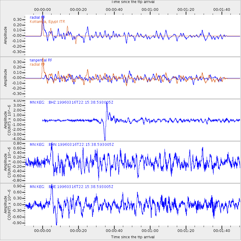
Signal To Noise
| Channel | StoN | STA | LTA |
| MN:KEG: :BHN:19960316T22:15:38.593005Z | 2.175406 | 1.8574524E-7 | 8.538417E-8 |
| MN:KEG: :BHE:19960316T22:15:38.593005Z | 2.9291935 | 2.3364231E-7 | 7.976336E-8 |
| MN:KEG: :BHZ:19960316T22:15:38.593005Z | 13.292063 | 1.1339948E-6 | 8.531368E-8 |
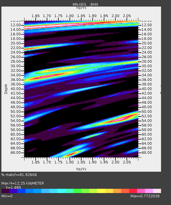
| Arrivals | |
| Ps | 1.4 SECOND |
| PpPs | 5.1 SECOND |
| PsPs/PpSs | 6.5 SECOND |

