
KEG Kottamya, Egypt - Earthquake Result Viewer
| ||||||||||||||||||
| ||||||||||||||||||
| ||||||||||||||||||
|
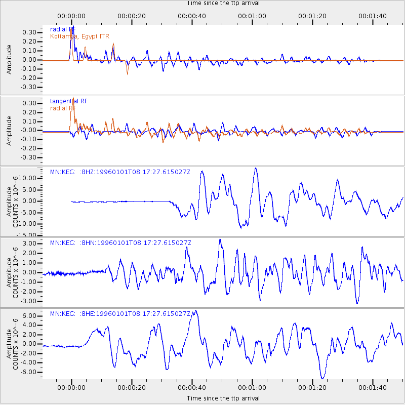
Signal To Noise
| Channel | StoN | STA | LTA |
| MN:KEG: :BHN:19960101T08:17:27.615027Z | 0.738279 | 6.499998E-8 | 8.804257E-8 |
| MN:KEG: :BHE:19960101T08:17:27.615027Z | 1.8319548 | 2.2090015E-7 | 1.2058166E-7 |
| MN:KEG: :BHZ:19960101T08:17:27.615027Z | 5.2524033 | 6.653084E-7 | 1.2666743E-7 |
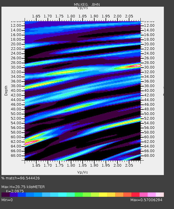
| Arrivals | |
| Ps | 5.1 SECOND |
| PpPs | 14 SECOND |
| PsPs/PpSs | 19 SECOND |

