You are here: Home > Network List > IU - Global Seismograph Network (GSN - IRIS/USGS) Stations List
> Station RSSD Black Hills, South Dakota, USA > Earthquake Result Viewer
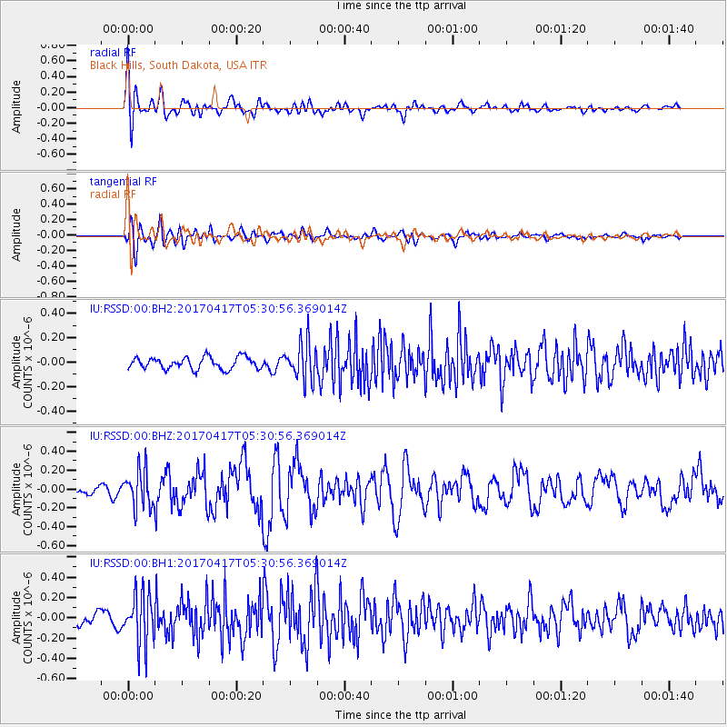
RSSD Black Hills, South Dakota, USA - Earthquake Result Viewer
*The percent match for this event was below the threshold and hence no stack was calculated.
| Earthquake location: |
Leeward Islands |
| Earthquake latitude/longitude: |
17.5/-61.1 |
| Earthquake time(UTC): |
2017/04/17 (107) 05:23:15 GMT |
| Earthquake Depth: |
21 km |
| Earthquake Magnitude: |
5.6 Mww |
| Earthquake Catalog/Contributor: |
NEIC PDE/us |
|
| Network: |
IU Global Seismograph Network (GSN - IRIS/USGS) |
| Station: |
RSSD Black Hills, South Dakota, USA |
| Lat/Lon: |
44.12 N/104.04 W |
| Elevation: |
2090 m |
|
| Distance: |
44.7 deg |
| Az: |
315.831 deg |
| Baz: |
112.576 deg |
| Ray Param: |
$rayparam |
*The percent match for this event was below the threshold and hence was not used in the summary stack. |
|
| Radial Match: |
74.49812 % |
| Radial Bump: |
400 |
| Transverse Match: |
64.90276 % |
| Transverse Bump: |
400 |
| SOD ConfigId: |
2028011 |
| Insert Time: |
2017-05-01 05:25:35.368 +0000 |
| GWidth: |
2.5 |
| Max Bumps: |
400 |
| Tol: |
0.001 |
|
Signal To Noise
| Channel | StoN | STA | LTA |
| IU:RSSD:00:BHZ:20170417T05:30:56.369014Z | 2.7557895 | 1.9857355E-7 | 7.2056864E-8 |
| IU:RSSD:00:BH1:20170417T05:30:56.369014Z | 5.490589 | 2.5297606E-7 | 4.6074483E-8 |
| IU:RSSD:00:BH2:20170417T05:30:56.369014Z | 3.2861085 | 1.583922E-7 | 4.8200537E-8 |
| Arrivals |
| Ps | |
| PpPs | |
| PsPs/PpSs | |


