You are here: Home > Network List > US - United States National Seismic Network Stations List
> Station DGMT Dagmar, Montana, USA > Earthquake Result Viewer
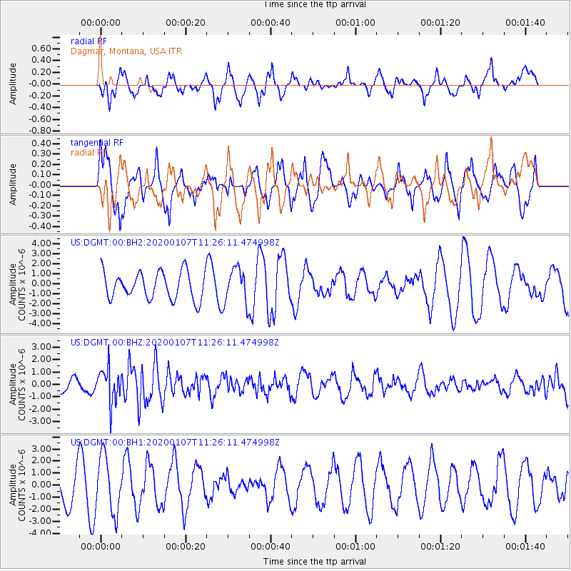
DGMT Dagmar, Montana, USA - Earthquake Result Viewer
*The percent match for this event was below the threshold and hence no stack was calculated.
| Earthquake location: |
Puerto Rico Region |
| Earthquake latitude/longitude: |
18.0/-66.8 |
| Earthquake time(UTC): |
2020/01/07 (007) 11:18:43 GMT |
| Earthquake Depth: |
9.0 km |
| Earthquake Magnitude: |
5.8 Mww |
| Earthquake Catalog/Contributor: |
NEIC PDE/pr |
|
| Network: |
US United States National Seismic Network |
| Station: |
DGMT Dagmar, Montana, USA |
| Lat/Lon: |
48.47 N/104.20 W |
| Elevation: |
0.0 m |
|
| Distance: |
42.9 deg |
| Az: |
323.56 deg |
| Baz: |
121.866 deg |
| Ray Param: |
$rayparam |
*The percent match for this event was below the threshold and hence was not used in the summary stack. |
|
| Radial Match: |
63.166706 % |
| Radial Bump: |
400 |
| Transverse Match: |
57.485607 % |
| Transverse Bump: |
400 |
| SOD ConfigId: |
20465011 |
| Insert Time: |
2020-01-21 11:46:26.000 +0000 |
| GWidth: |
2.5 |
| Max Bumps: |
400 |
| Tol: |
0.001 |
|
Signal To Noise
| Channel | StoN | STA | LTA |
| US:DGMT:00:BHZ:20200107T11:26:11.474998Z | 3.1043017 | 1.4024539E-6 | 4.517776E-7 |
| US:DGMT:00:BH1:20200107T11:26:11.474998Z | 2.1010768 | 2.3510152E-6 | 1.1189572E-6 |
| US:DGMT:00:BH2:20200107T11:26:11.474998Z | 1.2804153 | 1.7385455E-6 | 1.3577982E-6 |
| Arrivals |
| Ps | |
| PpPs | |
| PsPs/PpSs | |


