KEG Kottamya, Egypt - Earthquake Result Viewer
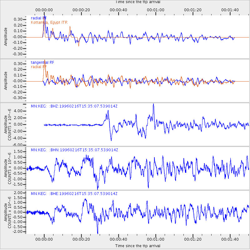
Earthquake location: Off East Coast Of Honshu, Japan
Earthquake latitude/longitude: 37.3/142.5
Earthquake time(UTC): 1996/02/16 (047) 15:22:57 GMT
Earthquake Depth: 33 km
Earthquake Magnitude: 6.2 MB, 6.2 MS, 6.7 UNKNOWN, 6.6 MW
Earthquake Catalog/Contributor: WHDF/NEIC
Network: MN MEDNET Project
Station: KEG Kottamya, Egypt
Lat/Lon: 29.93 N/31.83 E
Elevation: 460 m
Distance: 86.8 deg
Az: 305.548 deg
Baz: 48.328 deg
Ray Param: 0.043747883
Estimated Moho Depth: 35.25 km
Estimated Crust Vp/Vs: 1.68
Assumed Crust Vp: 6.312 km/s
Estimated Crust Vs: 3.769 km/s
Estimated Crust Poisson's Ratio: 0.22
Radial Match: 94.238846 %
Radial Bump: 400
Transverse Match: 85.62845 %
Transverse Bump: 400
SOD ConfigId: 6273
Insert Time: 2010-03-08 17:14:43.284 +0000
GWidth: 2.5
Max Bumps: 400
Tol: 0.001

Signal To Noise

ChannelStoNSTALTA
MN:KEG: :BHN:19960216T15:35:07.539014Z4.5718575.175808E-71.13210184E-7
MN:KEG: :BHE:19960216T15:35:07.539014Z3.94472484.484209E-71.13676094E-7
MN:KEG: :BHZ:19960216T15:35:07.539014Z21.2586981.6808278E-67.906542E-8
Arrivals
Ps3.9 SECOND
PpPs15 SECOND
PsPs/PpSs18 SECOND