
KEG Kottamya, Egypt - Earthquake Result Viewer
| ||||||||||||||||||
| ||||||||||||||||||
| ||||||||||||||||||
|
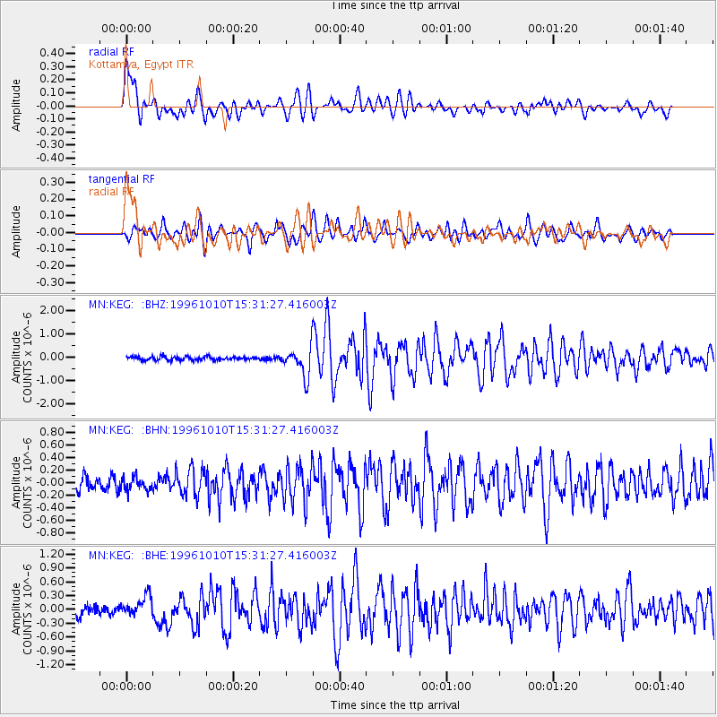
Signal To Noise
| Channel | StoN | STA | LTA |
| MN:KEG: :BHN:19961010T15:31:27.416003Z | 1.0597531 | 1.0423971E-7 | 9.8362264E-8 |
| MN:KEG: :BHE:19961010T15:31:27.416003Z | 2.3850145 | 2.1943944E-7 | 9.200759E-8 |
| MN:KEG: :BHZ:19961010T15:31:27.416003Z | 8.133796 | 6.19804E-7 | 7.6201076E-8 |
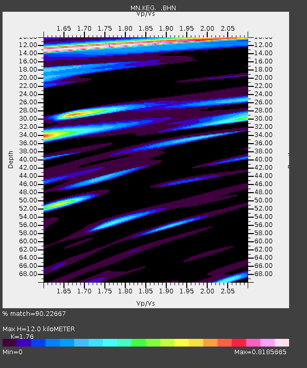
| Arrivals | |
| Ps | 1.5 SECOND |
| PpPs | 5.1 SECOND |
| PsPs/PpSs | 6.6 SECOND |

