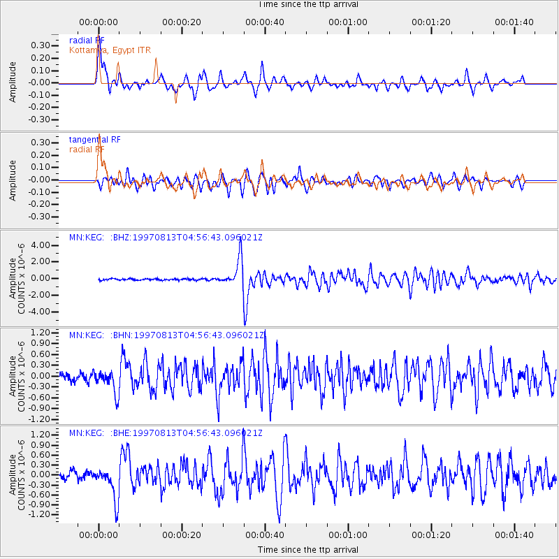
KEG Kottamya, Egypt - Earthquake Result Viewer
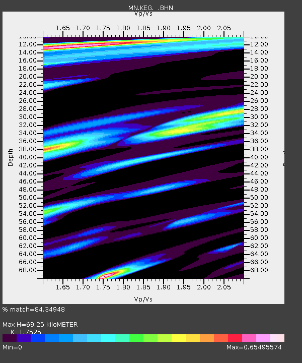
Earthquake location: Southwestern Ryukyu Isl., Japan
Earthquake latitude/longitude: 25.0/125.8
Earthquake time(UTC): 1997/08/13 (225) 04:45:04 GMT
Earthquake Depth: 55 km
Earthquake Magnitude: 6.0 MB, 5.6 MS, 6.1 UNKNOWN, 6.1 MW
Earthquake Catalog/Contributor: WHDF/NEIC
Network: MN MEDNET Project
Station: KEG Kottamya, Egypt
Lat/Lon: 29.93 N/31.83 E
Elevation: 460 m
Distance: 81.1 deg
Az: 298.764 deg
Baz: 66.357 deg
Ray Param: 0.0477225
Estimated Moho Depth: 69.25 km
Estimated Crust Vp/Vs: 1.75
Assumed Crust Vp: 6.312 km/s
Estimated Crust Vs: 3.602 km/s
Estimated Crust Poisson's Ratio: 0.26
Radial Match: 84.34948 %
Radial Bump: 400
Transverse Match: 80.96997 %
Transverse Bump: 400
SOD ConfigId: 6273
Insert Time: 2010-03-08 17:15:19.943 +0000
GWidth: 2.5
Max Bumps: 400
Tol: 0.001

Signal To Noise

ChannelStoNSTALTA
MN:KEG: :BHN:19970813T04:56:43.096021Z3.64200663.3086653E-79.084732E-8
MN:KEG: :BHE:19970813T04:56:43.096021Z4.8581965.270238E-71.08481395E-7
MN:KEG: :BHZ:19970813T04:56:43.096021Z20.9486871.7241557E-68.2303764E-8
Arrivals
Ps8.5 SECOND
PpPs29 SECOND
PsPs/PpSs38 SECOND