You are here: Home > Network List > AV - Alaska Volcano Observatory Stations List
> Station SPCR Ckakachatna River, Mount Spurr, Alaska > Earthquake Result Viewer
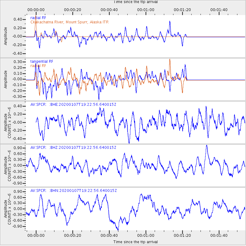
SPCR Ckakachatna River, Mount Spurr, Alaska - Earthquake Result Viewer
*The percent match for this event was below the threshold and hence no stack was calculated.
| Earthquake location: |
New Britain Region, P.N.G. |
| Earthquake latitude/longitude: |
-5.2/151.2 |
| Earthquake time(UTC): |
2020/01/07 (007) 19:11:35 GMT |
| Earthquake Depth: |
117 km |
| Earthquake Magnitude: |
6.0 Mww |
| Earthquake Catalog/Contributor: |
NEIC PDE/us |
|
| Network: |
AV Alaska Volcano Observatory |
| Station: |
SPCR Ckakachatna River, Mount Spurr, Alaska |
| Lat/Lon: |
61.20 N/152.21 W |
| Elevation: |
984 m |
|
| Distance: |
79.2 deg |
| Az: |
24.289 deg |
| Baz: |
237.786 deg |
| Ray Param: |
$rayparam |
*The percent match for this event was below the threshold and hence was not used in the summary stack. |
|
| Radial Match: |
46.199436 % |
| Radial Bump: |
400 |
| Transverse Match: |
39.06725 % |
| Transverse Bump: |
309 |
| SOD ConfigId: |
20465011 |
| Insert Time: |
2020-01-21 19:15:16.608 +0000 |
| GWidth: |
2.5 |
| Max Bumps: |
400 |
| Tol: |
0.001 |
|
Signal To Noise
| Channel | StoN | STA | LTA |
| AV:SPCR: :BHZ:20200107T19:22:56.640015Z | 2.6370847 | 4.053619E-7 | 1.5371592E-7 |
| AV:SPCR: :BHN:20200107T19:22:56.640015Z | 1.7554501 | 3.9410736E-7 | 2.24505E-7 |
| AV:SPCR: :BHE:20200107T19:22:56.640015Z | 0.9379828 | 1.388591E-7 | 1.4804013E-7 |
| Arrivals |
| Ps | |
| PpPs | |
| PsPs/PpSs | |


