
KEG Kottamya, Egypt - Earthquake Result Viewer
| ||||||||||||||||||
| ||||||||||||||||||
| ||||||||||||||||||
|
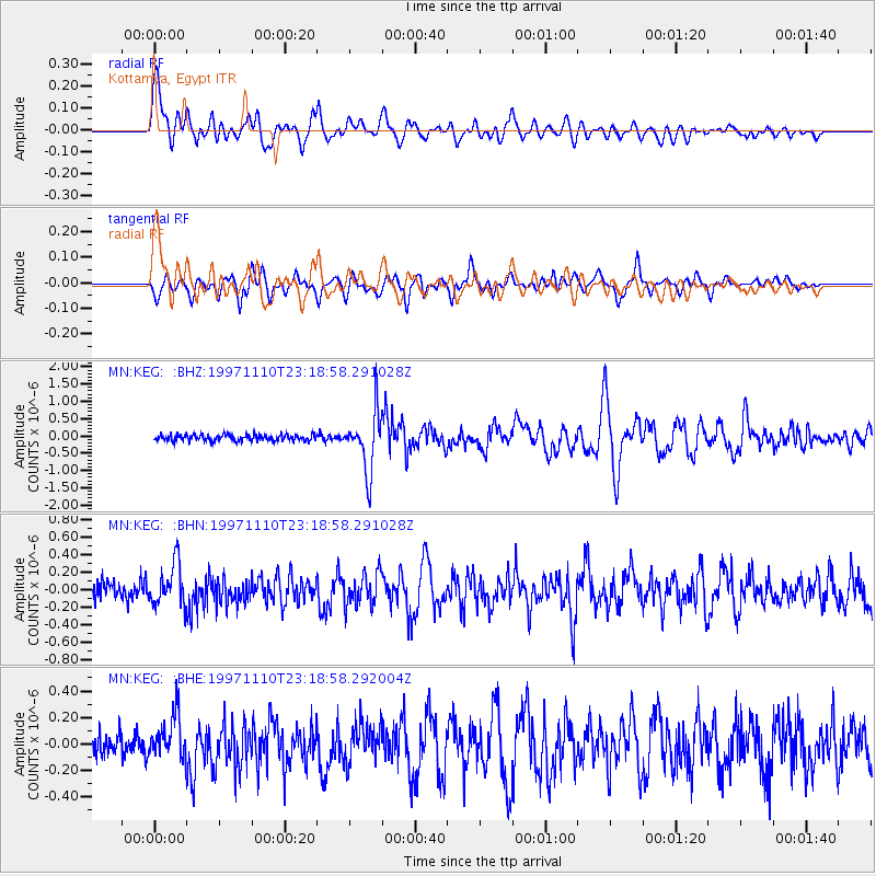
Signal To Noise
| Channel | StoN | STA | LTA |
| MN:KEG: :BHN:19971110T23:18:58.291028Z | 2.6066313 | 2.3894196E-7 | 9.1666955E-8 |
| MN:KEG: :BHE:19971110T23:18:58.292004Z | 1.9380541 | 1.6490463E-7 | 8.5087734E-8 |
| MN:KEG: :BHZ:19971110T23:18:58.291028Z | 9.17201 | 8.381686E-7 | 9.1383306E-8 |
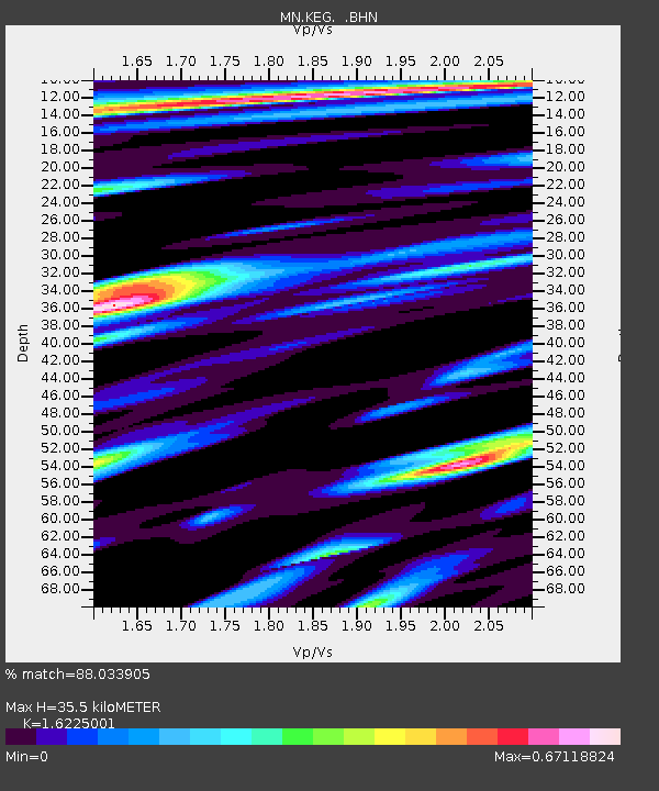
| Arrivals | |
| Ps | 3.6 SECOND |
| PpPs | 14 SECOND |
| PsPs/PpSs | 18 SECOND |

