You are here: Home > Network List > CI - Caltech Regional Seismic Network Stations List
> Station MPM Manuel Prospect Mine, California, USA > Earthquake Result Viewer
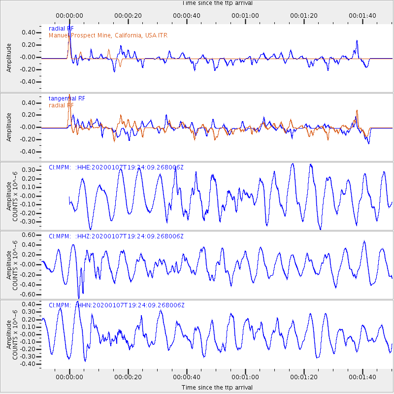
MPM Manuel Prospect Mine, California, USA - Earthquake Result Viewer
*The percent match for this event was below the threshold and hence no stack was calculated.
| Earthquake location: |
New Britain Region, P.N.G. |
| Earthquake latitude/longitude: |
-5.2/151.2 |
| Earthquake time(UTC): |
2020/01/07 (007) 19:11:35 GMT |
| Earthquake Depth: |
117 km |
| Earthquake Magnitude: |
6.0 Mww |
| Earthquake Catalog/Contributor: |
NEIC PDE/us |
|
| Network: |
CI Caltech Regional Seismic Network |
| Station: |
MPM Manuel Prospect Mine, California, USA |
| Lat/Lon: |
36.06 N/117.49 W |
| Elevation: |
185 m |
|
| Distance: |
94.0 deg |
| Az: |
54.303 deg |
| Baz: |
266.576 deg |
| Ray Param: |
$rayparam |
*The percent match for this event was below the threshold and hence was not used in the summary stack. |
|
| Radial Match: |
75.28616 % |
| Radial Bump: |
400 |
| Transverse Match: |
49.010544 % |
| Transverse Bump: |
400 |
| SOD ConfigId: |
20465011 |
| Insert Time: |
2020-01-21 19:16:50.272 +0000 |
| GWidth: |
2.5 |
| Max Bumps: |
400 |
| Tol: |
0.001 |
|
Signal To Noise
| Channel | StoN | STA | LTA |
| CI:MPM: :HHZ:20200107T19:24:09.268006Z | 3.655301 | 3.462105E-7 | 9.471463E-8 |
| CI:MPM: :HHN:20200107T19:24:09.268006Z | 1.4160371 | 2.878478E-7 | 2.0327703E-7 |
| CI:MPM: :HHE:20200107T19:24:09.268006Z | 0.9212822 | 1.7072182E-7 | 1.8530895E-7 |
| Arrivals |
| Ps | |
| PpPs | |
| PsPs/PpSs | |


