
KEG Kottamya, Egypt - Earthquake Result Viewer
| ||||||||||||||||||
| ||||||||||||||||||
| ||||||||||||||||||
|
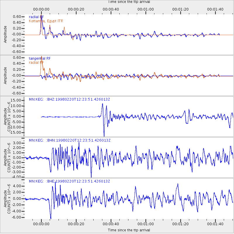
Signal To Noise
| Channel | StoN | STA | LTA |
| MN:KEG: :BHN:19980220T12:23:51.426013Z | 2.3069847 | 3.0523682E-7 | 1.3230986E-7 |
| MN:KEG: :BHE:19980220T12:23:51.426013Z | 4.3179264 | 6.5707746E-7 | 1.5217431E-7 |
| MN:KEG: :BHZ:19980220T12:23:51.426013Z | 13.450732 | 1.7600261E-6 | 1.3084984E-7 |
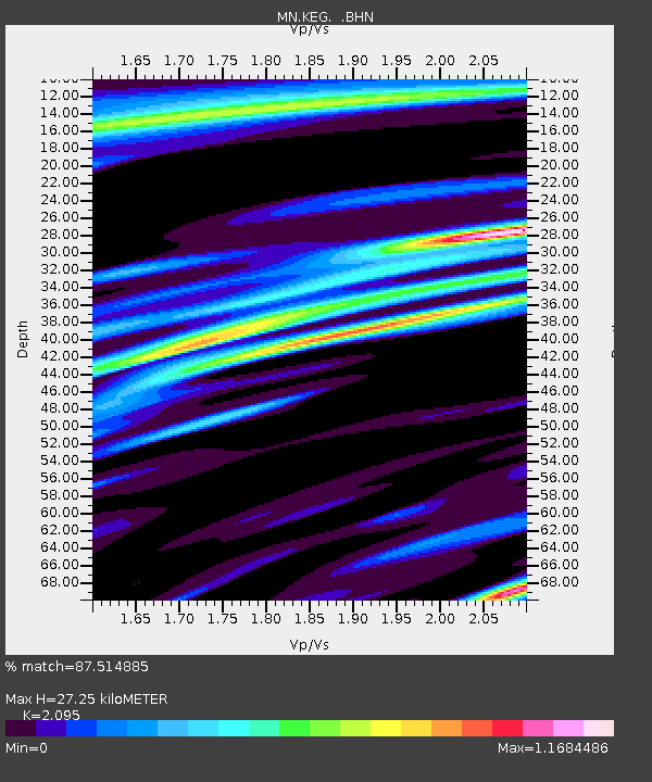
| Arrivals | |
| Ps | 5.0 SECOND |
| PpPs | 13 SECOND |
| PsPs/PpSs | 18 SECOND |

