
KEG Kottamya, Egypt - Earthquake Result Viewer
| ||||||||||||||||||
| ||||||||||||||||||
| ||||||||||||||||||
|
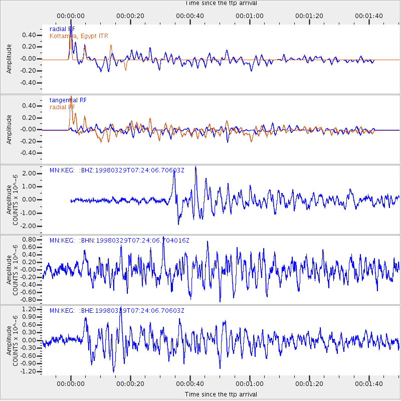
Signal To Noise
| Channel | StoN | STA | LTA |
| MN:KEG: :BHN:19980329T07:24:06.704016Z | 1.9902099 | 2.247978E-7 | 1.129518E-7 |
| MN:KEG: :BHE:19980329T07:24:06.70603Z | 2.4986022 | 2.9815402E-7 | 1.1932833E-7 |
| MN:KEG: :BHZ:19980329T07:24:06.70603Z | 7.442878 | 6.902128E-7 | 9.2734666E-8 |
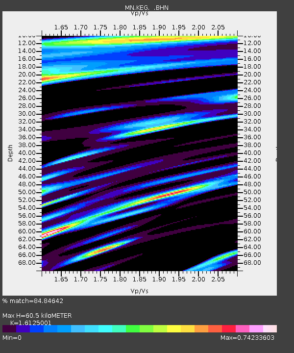
| Arrivals | |
| Ps | 6.2 SECOND |
| PpPs | 24 SECOND |
| PsPs/PpSs | 30 SECOND |

