
KEG Kottamya, Egypt - Earthquake Result Viewer
| ||||||||||||||||||
| ||||||||||||||||||
| ||||||||||||||||||
|
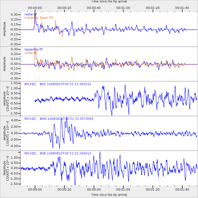
Signal To Noise
| Channel | StoN | STA | LTA |
| MN:KEG: :BHN:19980820T06:52:33.057996Z | 1.806633 | 2.0528316E-7 | 1.1362748E-7 |
| MN:KEG: :BHE:19980820T06:52:33.06001Z | 0.90600497 | 9.027026E-8 | 9.963551E-8 |
| MN:KEG: :BHZ:19980820T06:52:33.06001Z | 0.98818797 | 1.1956764E-7 | 1.2099687E-7 |
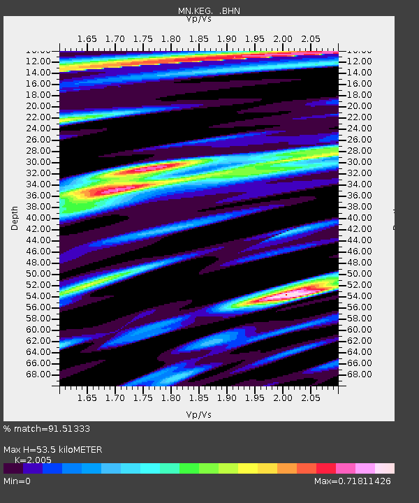
| Arrivals | |
| Ps | 8.7 SECOND |
| PpPs | 25 SECOND |
| PsPs/PpSs | 34 SECOND |

