You are here: Home > Network List > TA - USArray Transportable Network (new EarthScope stations) Stations List
> Station C16K Lisburne Hills, AK, USA > Earthquake Result Viewer
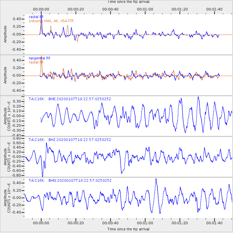
C16K Lisburne Hills, AK, USA - Earthquake Result Viewer
*The percent match for this event was below the threshold and hence no stack was calculated.
| Earthquake location: |
New Britain Region, P.N.G. |
| Earthquake latitude/longitude: |
-5.2/151.2 |
| Earthquake time(UTC): |
2020/01/07 (007) 19:11:35 GMT |
| Earthquake Depth: |
117 km |
| Earthquake Magnitude: |
6.0 Mww |
| Earthquake Catalog/Contributor: |
NEIC PDE/us |
|
| Network: |
TA USArray Transportable Network (new EarthScope stations) |
| Station: |
C16K Lisburne Hills, AK, USA |
| Lat/Lon: |
68.27 N/165.34 W |
| Elevation: |
102 m |
|
| Distance: |
79.3 deg |
| Az: |
15.097 deg |
| Baz: |
224.168 deg |
| Ray Param: |
$rayparam |
*The percent match for this event was below the threshold and hence was not used in the summary stack. |
|
| Radial Match: |
55.47177 % |
| Radial Bump: |
325 |
| Transverse Match: |
53.5564 % |
| Transverse Bump: |
400 |
| SOD ConfigId: |
20465011 |
| Insert Time: |
2020-01-21 19:21:35.739 +0000 |
| GWidth: |
2.5 |
| Max Bumps: |
400 |
| Tol: |
0.001 |
|
Signal To Noise
| Channel | StoN | STA | LTA |
| TA:C16K: :BHZ:20200107T19:22:57.025025Z | 3.0376468 | 4.0017545E-7 | 1.3173864E-7 |
| TA:C16K: :BHN:20200107T19:22:57.025025Z | 1.9524006 | 1.5309747E-7 | 7.841499E-8 |
| TA:C16K: :BHE:20200107T19:22:57.025025Z | 1.3303124 | 1.3758283E-7 | 1.0342145E-7 |
| Arrivals |
| Ps | |
| PpPs | |
| PsPs/PpSs | |


