You are here: Home > Network List > TA - USArray Transportable Network (new EarthScope stations) Stations List
> Station M11K Mekoryuk, AK, USA > Earthquake Result Viewer
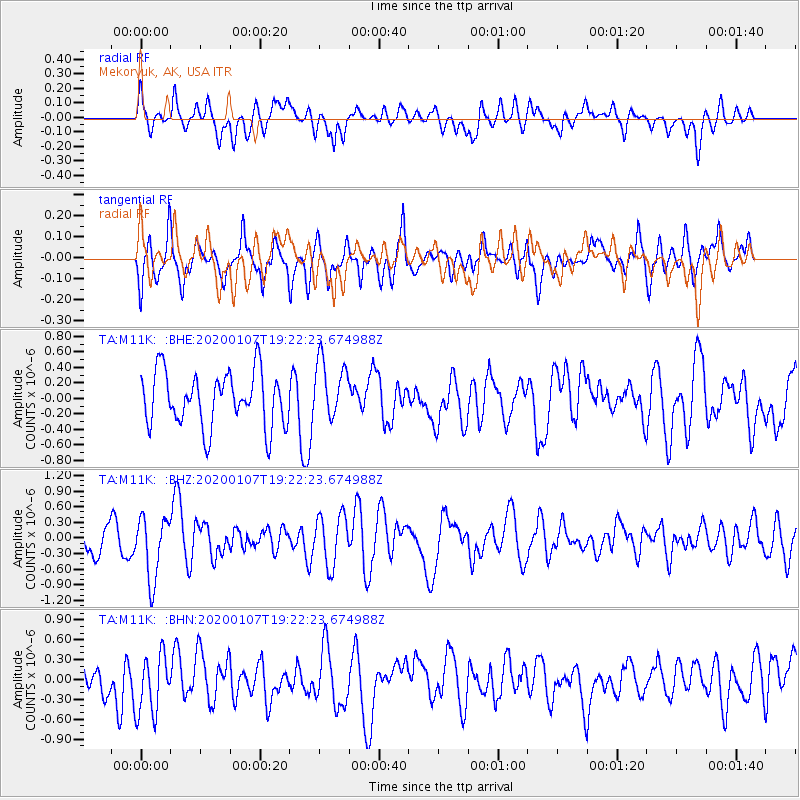
M11K Mekoryuk, AK, USA - Earthquake Result Viewer
*The percent match for this event was below the threshold and hence no stack was calculated.
| Earthquake location: |
New Britain Region, P.N.G. |
| Earthquake latitude/longitude: |
-5.2/151.2 |
| Earthquake time(UTC): |
2020/01/07 (007) 19:11:35 GMT |
| Earthquake Depth: |
117 km |
| Earthquake Magnitude: |
6.0 Mww |
| Earthquake Catalog/Contributor: |
NEIC PDE/us |
|
| Network: |
TA USArray Transportable Network (new EarthScope stations) |
| Station: |
M11K Mekoryuk, AK, USA |
| Lat/Lon: |
60.38 N/166.20 W |
| Elevation: |
3.0 m |
|
| Distance: |
73.3 deg |
| Az: |
20.528 deg |
| Baz: |
224.683 deg |
| Ray Param: |
$rayparam |
*The percent match for this event was below the threshold and hence was not used in the summary stack. |
|
| Radial Match: |
49.50181 % |
| Radial Bump: |
400 |
| Transverse Match: |
63.992203 % |
| Transverse Bump: |
400 |
| SOD ConfigId: |
20465011 |
| Insert Time: |
2020-01-21 19:23:13.682 +0000 |
| GWidth: |
2.5 |
| Max Bumps: |
400 |
| Tol: |
0.001 |
|
Signal To Noise
| Channel | StoN | STA | LTA |
| TA:M11K: :BHZ:20200107T19:22:23.674988Z | 2.140321 | 6.029824E-7 | 2.8172522E-7 |
| TA:M11K: :BHN:20200107T19:22:23.674988Z | 1.4455025 | 4.5345092E-7 | 3.136978E-7 |
| TA:M11K: :BHE:20200107T19:22:23.674988Z | 1.1028723 | 3.8389905E-7 | 3.4809023E-7 |
| Arrivals |
| Ps | |
| PpPs | |
| PsPs/PpSs | |


