You are here: Home > Network List > US - United States National Seismic Network Stations List
> Station ELK Elko, Nevada, USA > Earthquake Result Viewer
ELK Elko, Nevada, USA - Earthquake Result Viewer
*The percent match for this event was below the threshold and hence no stack was calculated.
| Earthquake location: |
Leeward Islands |
| Earthquake latitude/longitude: |
17.5/-61.1 |
| Earthquake time(UTC): |
2017/04/17 (107) 05:23:15 GMT |
| Earthquake Depth: |
21 km |
| Earthquake Magnitude: |
5.6 Mww |
| Earthquake Catalog/Contributor: |
NEIC PDE/us |
|
| Network: |
US United States National Seismic Network |
| Station: |
ELK Elko, Nevada, USA |
| Lat/Lon: |
40.74 N/115.24 W |
| Elevation: |
2210 m |
|
| Distance: |
51.7 deg |
| Az: |
308.386 deg |
| Baz: |
100.055 deg |
| Ray Param: |
$rayparam |
*The percent match for this event was below the threshold and hence was not used in the summary stack. |
|
| Radial Match: |
56.064575 % |
| Radial Bump: |
367 |
| Transverse Match: |
73.226265 % |
| Transverse Bump: |
400 |
| SOD ConfigId: |
2028011 |
| Insert Time: |
2017-05-01 05:27:26.700 +0000 |
| GWidth: |
2.5 |
| Max Bumps: |
400 |
| Tol: |
0.001 |
|
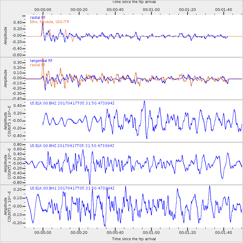
Signal To Noise
| Channel | StoN | STA | LTA |
| US:ELK:00:BHZ:20170417T05:31:50.473994Z | 1.8268148 | 1.9774114E-7 | 1.08243675E-7 |
| US:ELK:00:BH1:20170417T05:31:50.473994Z | 0.47196808 | 3.7137063E-8 | 7.868554E-8 |
| US:ELK:00:BH2:20170417T05:31:50.473994Z | 1.7922958 | 1.3948151E-7 | 7.782282E-8 |
| Arrivals |
| Ps | |
| PpPs | |
| PsPs/PpSs | |


