You are here: Home > Network List > US - United States National Seismic Network Stations List
> Station HDIL Hopedale, Illinois, USA > Earthquake Result Viewer
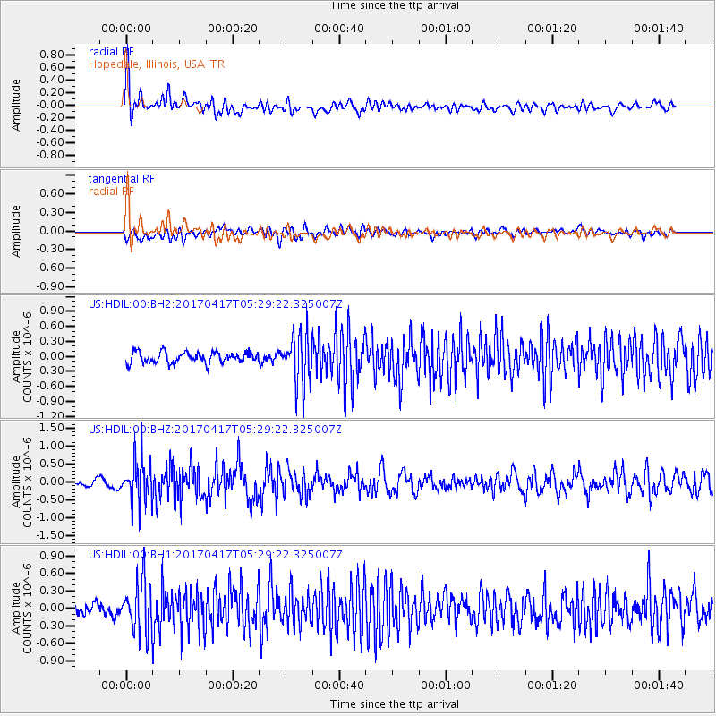
HDIL Hopedale, Illinois, USA - Earthquake Result Viewer
*The percent match for this event was below the threshold and hence no stack was calculated.
| Earthquake location: |
Leeward Islands |
| Earthquake latitude/longitude: |
17.5/-61.1 |
| Earthquake time(UTC): |
2017/04/17 (107) 05:23:15 GMT |
| Earthquake Depth: |
21 km |
| Earthquake Magnitude: |
5.6 Mww |
| Earthquake Catalog/Contributor: |
NEIC PDE/us |
|
| Network: |
US United States National Seismic Network |
| Station: |
HDIL Hopedale, Illinois, USA |
| Lat/Lon: |
40.56 N/89.29 W |
| Elevation: |
219 m |
|
| Distance: |
33.4 deg |
| Az: |
319.277 deg |
| Baz: |
125.191 deg |
| Ray Param: |
$rayparam |
*The percent match for this event was below the threshold and hence was not used in the summary stack. |
|
| Radial Match: |
66.82831 % |
| Radial Bump: |
400 |
| Transverse Match: |
61.058655 % |
| Transverse Bump: |
400 |
| SOD ConfigId: |
2028011 |
| Insert Time: |
2017-05-01 05:27:33.048 +0000 |
| GWidth: |
2.5 |
| Max Bumps: |
400 |
| Tol: |
0.001 |
|
Signal To Noise
| Channel | StoN | STA | LTA |
| US:HDIL:00:BHZ:20170417T05:29:22.325007Z | 4.856852 | 6.089456E-7 | 1.2537866E-7 |
| US:HDIL:00:BH1:20170417T05:29:22.325007Z | 4.584992 | 4.3865475E-7 | 9.5671865E-8 |
| US:HDIL:00:BH2:20170417T05:29:22.325007Z | 4.710612 | 5.050167E-7 | 1.0720831E-7 |
| Arrivals |
| Ps | |
| PpPs | |
| PsPs/PpSs | |


