You are here: Home > Network List > MN - MEDNET Project Stations List
> Station KEG Kottamya, Egypt > Earthquake Result Viewer
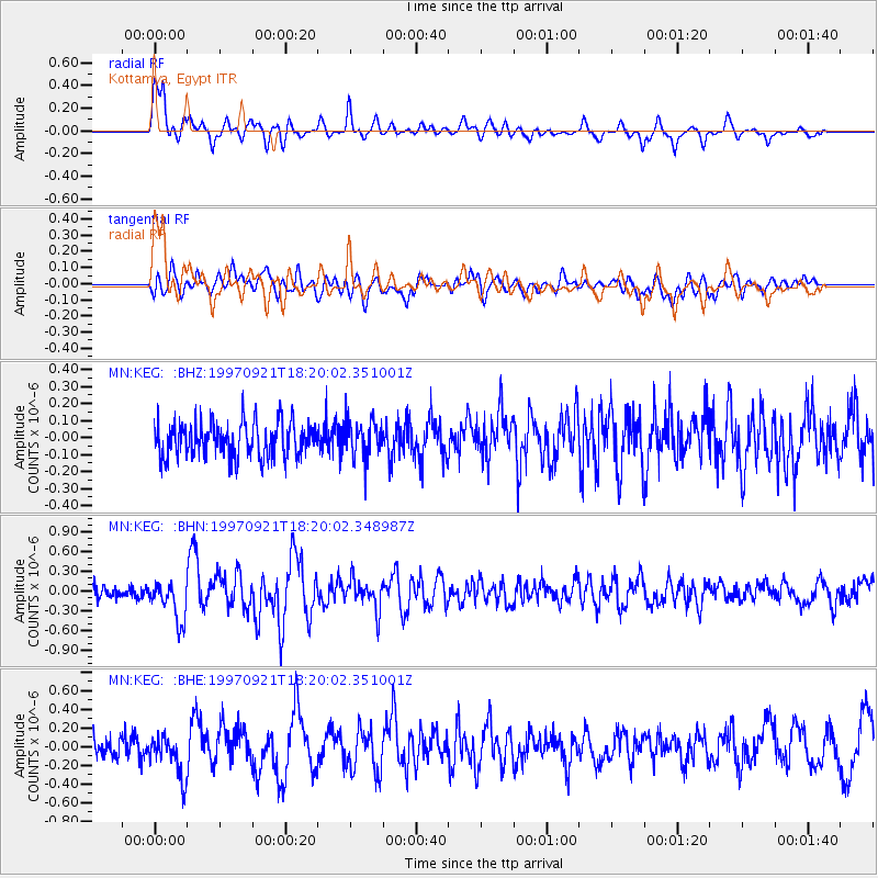
KEG Kottamya, Egypt - Earthquake Result Viewer
*The percent match for this event was below the threshold and hence no stack was calculated.
| Earthquake location: |
Lake Tanganyika Region |
| Earthquake latitude/longitude: |
-7.4/30.4 |
| Earthquake time(UTC): |
1997/09/21 (264) 18:13:22 GMT |
| Earthquake Depth: |
10 km |
| Earthquake Magnitude: |
5.7 MB, 6.2 MS, 6.0 UNKNOWN, 5.9 MW |
| Earthquake Catalog/Contributor: |
WHDF/NEIC |
|
| Network: |
MN MEDNET Project |
| Station: |
KEG Kottamya, Egypt |
| Lat/Lon: |
29.93 N/31.83 E |
| Elevation: |
460 m |
|
| Distance: |
37.1 deg |
| Az: |
2.1 deg |
| Baz: |
182.4 deg |
| Ray Param: |
$rayparam |
*The percent match for this event was below the threshold and hence was not used in the summary stack. |
|
| Radial Match: |
79.90319 % |
| Radial Bump: |
400 |
| Transverse Match: |
70.66395 % |
| Transverse Bump: |
400 |
| SOD ConfigId: |
4480 |
| Insert Time: |
2010-03-08 17:16:23.532 +0000 |
| GWidth: |
2.5 |
| Max Bumps: |
400 |
| Tol: |
0.001 |
|
Signal To Noise
| Channel | StoN | STA | LTA |
| MN:KEG: :BHN:19970921T18:20:02.348987Z | 3.0108073 | 3.0064194E-7 | 9.985427E-8 |
| MN:KEG: :BHE:19970921T18:20:02.351001Z | 2.4891264 | 2.2497878E-7 | 9.0384624E-8 |
| MN:KEG: :BHZ:19970921T18:20:02.351001Z | 1.0633136 | 1.08499094E-7 | 1.0203866E-7 |
| Arrivals |
| Ps | |
| PpPs | |
| PsPs/PpSs | |


