You are here: Home > Network List > CN - Canadian National Seismograph Network Stations List
> Station INK INUVIK, NT > Earthquake Result Viewer
INK INUVIK, NT - Earthquake Result Viewer
*The percent match for this event was below the threshold and hence no stack was calculated.
| Earthquake location: |
Off Coast Of Jalisco, Mexico |
| Earthquake latitude/longitude: |
18.5/-105.1 |
| Earthquake time(UTC): |
2020/01/10 (010) 15:21:26 GMT |
| Earthquake Depth: |
44 km |
| Earthquake Magnitude: |
5.5 Mww |
| Earthquake Catalog/Contributor: |
NEIC PDE/us |
|
| Network: |
CN Canadian National Seismograph Network |
| Station: |
INK INUVIK, NT |
| Lat/Lon: |
68.31 N/133.53 W |
| Elevation: |
44 m |
|
| Distance: |
52.9 deg |
| Az: |
347.187 deg |
| Baz: |
145.525 deg |
| Ray Param: |
$rayparam |
*The percent match for this event was below the threshold and hence was not used in the summary stack. |
|
| Radial Match: |
50.172546 % |
| Radial Bump: |
400 |
| Transverse Match: |
52.8453 % |
| Transverse Bump: |
400 |
| SOD ConfigId: |
20465011 |
| Insert Time: |
2020-01-24 15:25:35.259 +0000 |
| GWidth: |
2.5 |
| Max Bumps: |
400 |
| Tol: |
0.001 |
|
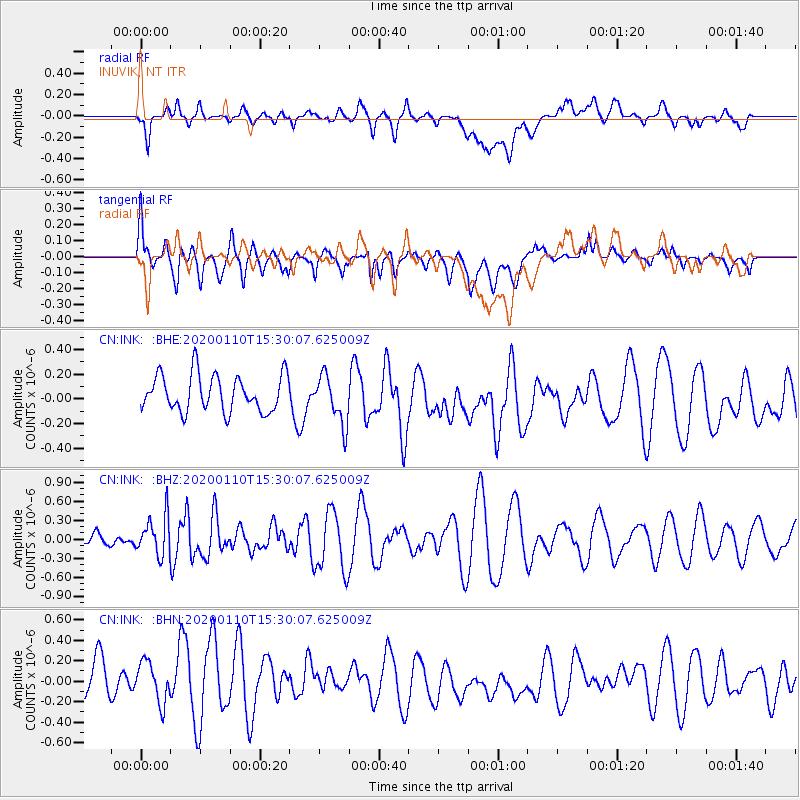
Signal To Noise
| Channel | StoN | STA | LTA |
| CN:INK: :BHZ:20200110T15:30:07.625009Z | 1.4741808 | 3.0417465E-7 | 2.0633469E-7 |
| CN:INK: :BHN:20200110T15:30:07.625009Z | 0.95987463 | 2.5672776E-7 | 2.6745965E-7 |
| CN:INK: :BHE:20200110T15:30:07.625009Z | 1.3344678 | 1.9747566E-7 | 1.4798084E-7 |
| Arrivals |
| Ps | |
| PpPs | |
| PsPs/PpSs | |


