You are here: Home > Network List > BK - Berkeley Digital Seismograph Network Stations List
> Station HUMO Hull Mountain, OR > Earthquake Result Viewer
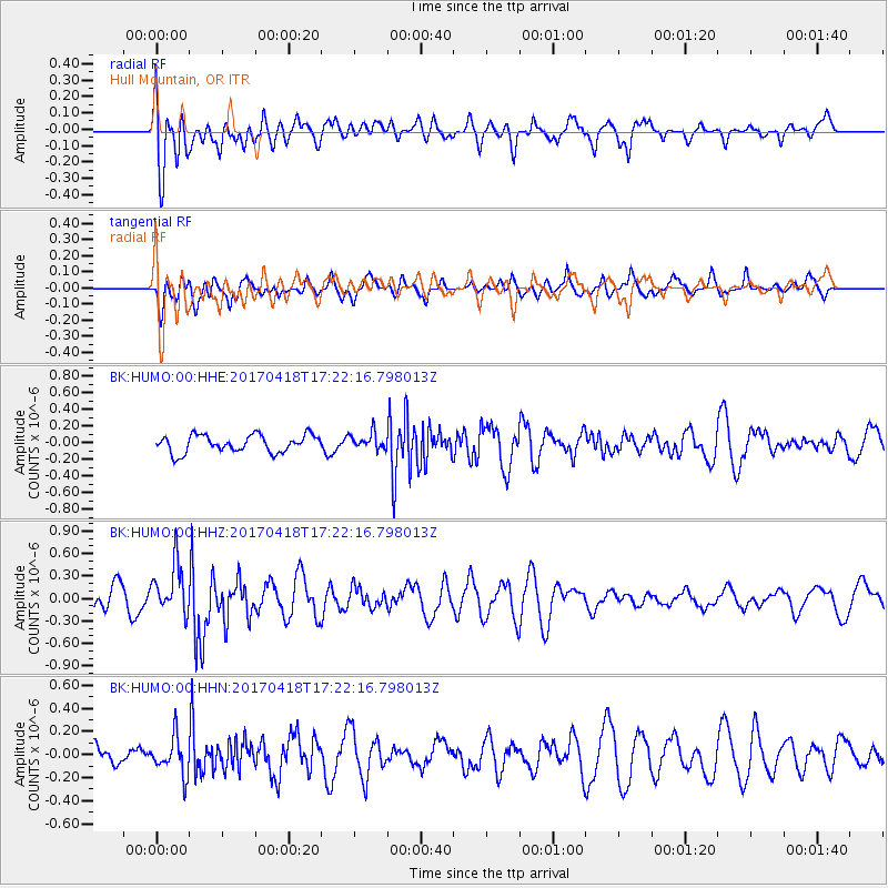
HUMO Hull Mountain, OR - Earthquake Result Viewer
*The percent match for this event was below the threshold and hence no stack was calculated.
| Earthquake location: |
Fiji Islands Region |
| Earthquake latitude/longitude: |
-18.1/-178.4 |
| Earthquake time(UTC): |
2017/04/18 (108) 17:11:47 GMT |
| Earthquake Depth: |
626 km |
| Earthquake Magnitude: |
6.0 Mww |
| Earthquake Catalog/Contributor: |
NEIC PDE/us |
|
| Network: |
BK Berkeley Digital Seismograph Network |
| Station: |
HUMO Hull Mountain, OR |
| Lat/Lon: |
42.61 N/122.96 W |
| Elevation: |
555 m |
|
| Distance: |
79.0 deg |
| Az: |
38.269 deg |
| Baz: |
232.954 deg |
| Ray Param: |
$rayparam |
*The percent match for this event was below the threshold and hence was not used in the summary stack. |
|
| Radial Match: |
66.53453 % |
| Radial Bump: |
400 |
| Transverse Match: |
68.23009 % |
| Transverse Bump: |
400 |
| SOD ConfigId: |
2028011 |
| Insert Time: |
2017-05-02 17:14:57.923 +0000 |
| GWidth: |
2.5 |
| Max Bumps: |
400 |
| Tol: |
0.001 |
|
Signal To Noise
| Channel | StoN | STA | LTA |
| BK:HUMO:00:HHZ:20170418T17:22:16.798013Z | 1.639002 | 3.2807725E-7 | 2.0016893E-7 |
| BK:HUMO:00:HHN:20170418T17:22:16.798013Z | 1.212589 | 1.6146284E-7 | 1.3315545E-7 |
| BK:HUMO:00:HHE:20170418T17:22:16.798013Z | 0.9522345 | 9.8558246E-8 | 1.0350208E-7 |
| Arrivals |
| Ps | |
| PpPs | |
| PsPs/PpSs | |


