You are here: Home > Network List > IU - Global Seismograph Network (GSN - IRIS/USGS) Stations List
> Station JOHN Johnston Island, USA > Earthquake Result Viewer
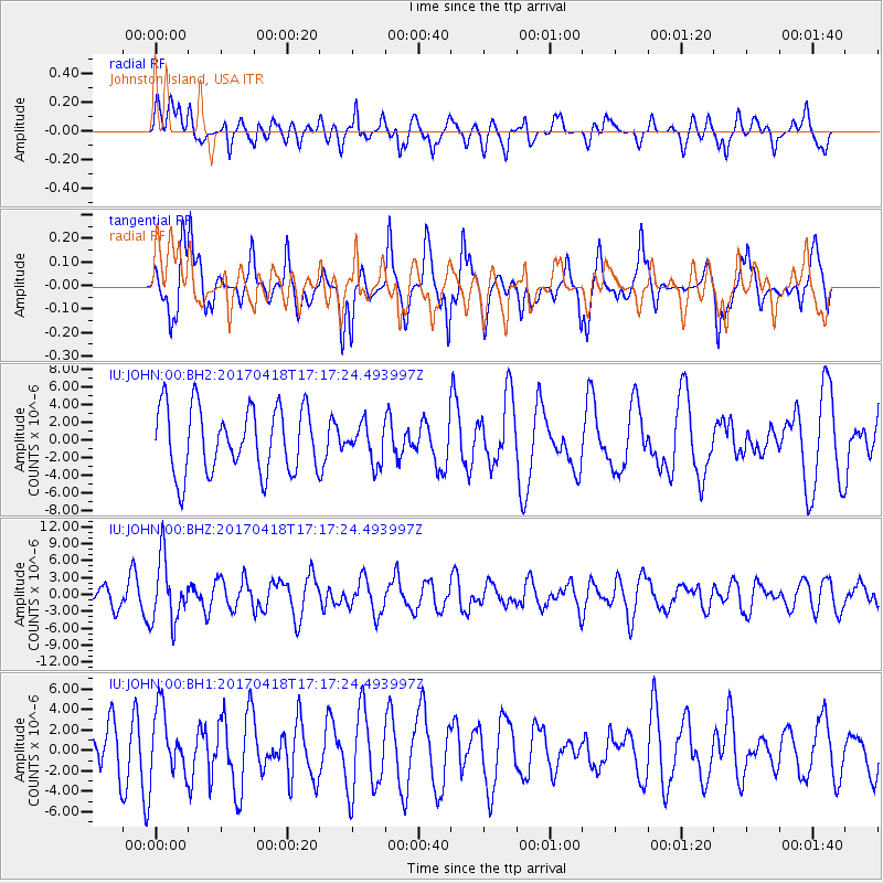
JOHN Johnston Island, USA - Earthquake Result Viewer
*The percent match for this event was below the threshold and hence no stack was calculated.
| Earthquake location: |
Fiji Islands Region |
| Earthquake latitude/longitude: |
-18.1/-178.4 |
| Earthquake time(UTC): |
2017/04/18 (108) 17:11:47 GMT |
| Earthquake Depth: |
626 km |
| Earthquake Magnitude: |
6.0 Mww |
| Earthquake Catalog/Contributor: |
NEIC PDE/us |
|
| Network: |
IU Global Seismograph Network (GSN - IRIS/USGS) |
| Station: |
JOHN Johnston Island, USA |
| Lat/Lon: |
16.73 N/169.53 W |
| Elevation: |
2.0 m |
|
| Distance: |
35.7 deg |
| Az: |
14.68 deg |
| Baz: |
194.574 deg |
| Ray Param: |
$rayparam |
*The percent match for this event was below the threshold and hence was not used in the summary stack. |
|
| Radial Match: |
63.352825 % |
| Radial Bump: |
400 |
| Transverse Match: |
58.500313 % |
| Transverse Bump: |
400 |
| SOD ConfigId: |
2028011 |
| Insert Time: |
2017-05-02 17:16:27.857 +0000 |
| GWidth: |
2.5 |
| Max Bumps: |
400 |
| Tol: |
0.001 |
|
Signal To Noise
| Channel | StoN | STA | LTA |
| IU:JOHN:00:BHZ:20170418T17:17:24.493997Z | 1.9747264 | 5.5639166E-6 | 2.8175634E-6 |
| IU:JOHN:00:BH1:20170418T17:17:24.493997Z | 1.6140949 | 3.1758418E-6 | 1.9675683E-6 |
| IU:JOHN:00:BH2:20170418T17:17:24.493997Z | 0.5763943 | 2.1397352E-6 | 3.7122768E-6 |
| Arrivals |
| Ps | |
| PpPs | |
| PsPs/PpSs | |


