You are here: Home > Network List > CI - Caltech Regional Seismic Network Stations List
> Station SWS Sam W. Stewart, Westmorland, CA, USA > Earthquake Result Viewer
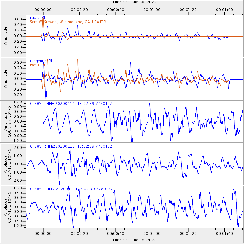
SWS Sam W. Stewart, Westmorland, CA, USA - Earthquake Result Viewer
*The percent match for this event was below the threshold and hence no stack was calculated.
| Earthquake location: |
Puerto Rico Region |
| Earthquake latitude/longitude: |
17.9/-66.8 |
| Earthquake time(UTC): |
2020/01/11 (011) 12:54:44 GMT |
| Earthquake Depth: |
5.0 km |
| Earthquake Magnitude: |
6.0 Mi |
| Earthquake Catalog/Contributor: |
NEIC PDE/pt |
|
| Network: |
CI Caltech Regional Seismic Network |
| Station: |
SWS Sam W. Stewart, Westmorland, CA, USA |
| Lat/Lon: |
32.94 N/115.80 W |
| Elevation: |
140 m |
|
| Distance: |
46.3 deg |
| Az: |
298.685 deg |
| Baz: |
96.501 deg |
| Ray Param: |
$rayparam |
*The percent match for this event was below the threshold and hence was not used in the summary stack. |
|
| Radial Match: |
67.077095 % |
| Radial Bump: |
400 |
| Transverse Match: |
62.88344 % |
| Transverse Bump: |
400 |
| SOD ConfigId: |
20465011 |
| Insert Time: |
2020-01-25 13:00:48.871 +0000 |
| GWidth: |
2.5 |
| Max Bumps: |
400 |
| Tol: |
0.001 |
|
Signal To Noise
| Channel | StoN | STA | LTA |
| CI:SWS: :HHZ:20200111T13:02:39.778015Z | 2.9534264 | 5.7198463E-7 | 1.9366814E-7 |
| CI:SWS: :HHN:20200111T13:02:39.778015Z | 0.5722237 | 2.009322E-7 | 3.5114275E-7 |
| CI:SWS: :HHE:20200111T13:02:39.778015Z | 0.9631622 | 3.9108212E-7 | 4.0603973E-7 |
| Arrivals |
| Ps | |
| PpPs | |
| PsPs/PpSs | |


