You are here: Home > Network List > US - United States National Seismic Network Stations List
> Station WUAZ Wupatki, Arizona, USA > Earthquake Result Viewer
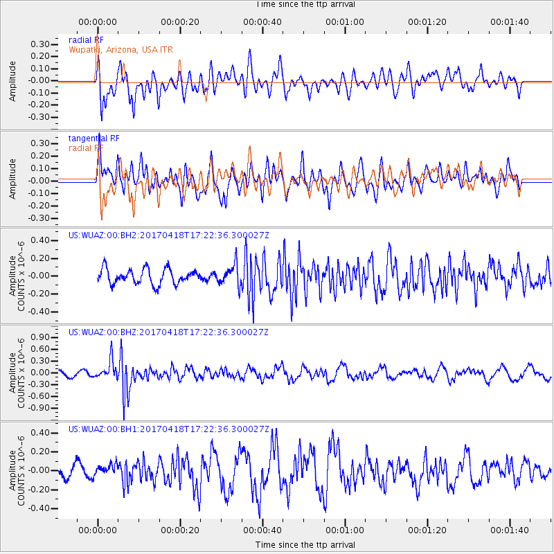
WUAZ Wupatki, Arizona, USA - Earthquake Result Viewer
*The percent match for this event was below the threshold and hence no stack was calculated.
| Earthquake location: |
Fiji Islands Region |
| Earthquake latitude/longitude: |
-18.1/-178.4 |
| Earthquake time(UTC): |
2017/04/18 (108) 17:11:47 GMT |
| Earthquake Depth: |
626 km |
| Earthquake Magnitude: |
6.0 Mww |
| Earthquake Catalog/Contributor: |
NEIC PDE/us |
|
| Network: |
US United States National Seismic Network |
| Station: |
WUAZ Wupatki, Arizona, USA |
| Lat/Lon: |
35.52 N/111.37 W |
| Elevation: |
1592 m |
|
| Distance: |
82.8 deg |
| Az: |
49.199 deg |
| Baz: |
241.983 deg |
| Ray Param: |
$rayparam |
*The percent match for this event was below the threshold and hence was not used in the summary stack. |
|
| Radial Match: |
55.91872 % |
| Radial Bump: |
400 |
| Transverse Match: |
63.86245 % |
| Transverse Bump: |
400 |
| SOD ConfigId: |
2028011 |
| Insert Time: |
2017-05-02 17:17:58.543 +0000 |
| GWidth: |
2.5 |
| Max Bumps: |
400 |
| Tol: |
0.001 |
|
Signal To Noise
| Channel | StoN | STA | LTA |
| US:WUAZ:00:BHZ:20170418T17:22:36.300027Z | 3.4666646 | 2.441647E-7 | 7.043217E-8 |
| US:WUAZ:00:BH1:20170418T17:22:36.300027Z | 0.8497601 | 5.909764E-8 | 6.954627E-8 |
| US:WUAZ:00:BH2:20170418T17:22:36.300027Z | 1.4205328 | 1.193594E-7 | 8.402439E-8 |
| Arrivals |
| Ps | |
| PpPs | |
| PsPs/PpSs | |


