You are here: Home > Network List > AZ - ANZA Regional Network Stations List
> Station SMER AZ.SMER > Earthquake Result Viewer
SMER AZ.SMER - Earthquake Result Viewer
*The percent match for this event was below the threshold and hence no stack was calculated.
| Earthquake location: |
North Of Ascension Island |
| Earthquake latitude/longitude: |
0.1/-17.1 |
| Earthquake time(UTC): |
2020/01/16 (016) 09:58:19 GMT |
| Earthquake Depth: |
10 km |
| Earthquake Magnitude: |
5.5 Mww |
| Earthquake Catalog/Contributor: |
NEIC PDE/us |
|
| Network: |
AZ ANZA Regional Network |
| Station: |
SMER AZ.SMER |
| Lat/Lon: |
33.46 N/117.17 W |
| Elevation: |
355 m |
|
| Distance: |
98.4 deg |
| Az: |
303.704 deg |
| Baz: |
84.336 deg |
| Ray Param: |
$rayparam |
*The percent match for this event was below the threshold and hence was not used in the summary stack. |
|
| Radial Match: |
81.0631 % |
| Radial Bump: |
265 |
| Transverse Match: |
71.19689 % |
| Transverse Bump: |
400 |
| SOD ConfigId: |
20465011 |
| Insert Time: |
2020-01-30 09:58:59.360 +0000 |
| GWidth: |
2.5 |
| Max Bumps: |
400 |
| Tol: |
0.001 |
|
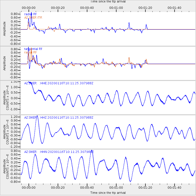
Signal To Noise
| Channel | StoN | STA | LTA |
| AZ:SMER: :HHZ:20200116T10:11:25.307988Z | 1.7068914 | 5.678088E-7 | 3.3265667E-7 |
| AZ:SMER: :HHN:20200116T10:11:25.307988Z | 1.5459024 | 4.6466909E-7 | 3.0058112E-7 |
| AZ:SMER: :HHE:20200116T10:11:25.307988Z | 1.3229508 | 6.778822E-7 | 5.1240164E-7 |
| Arrivals |
| Ps | |
| PpPs | |
| PsPs/PpSs | |


