You are here: Home > Network List > TJ - Tajikistan National Seismic Network Stations List
> Station GARM Garm, Tajikistan > Earthquake Result Viewer
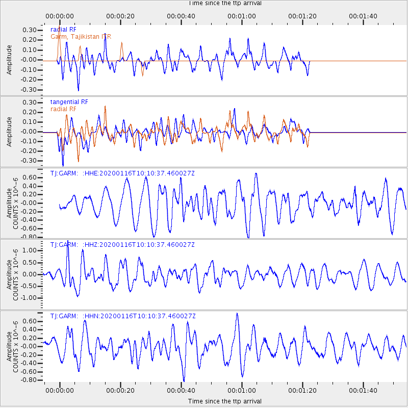
GARM Garm, Tajikistan - Earthquake Result Viewer
*The percent match for this event was below the threshold and hence no stack was calculated.
| Earthquake location: |
North Of Ascension Island |
| Earthquake latitude/longitude: |
0.1/-17.1 |
| Earthquake time(UTC): |
2020/01/16 (016) 09:58:19 GMT |
| Earthquake Depth: |
10 km |
| Earthquake Magnitude: |
5.5 Mww |
| Earthquake Catalog/Contributor: |
NEIC PDE/us |
|
| Network: |
TJ Tajikistan National Seismic Network |
| Station: |
GARM Garm, Tajikistan |
| Lat/Lon: |
39.00 N/70.32 E |
| Elevation: |
1305 m |
|
| Distance: |
87.9 deg |
| Az: |
51.162 deg |
| Baz: |
268.454 deg |
| Ray Param: |
$rayparam |
*The percent match for this event was below the threshold and hence was not used in the summary stack. |
|
| Radial Match: |
76.74089 % |
| Radial Bump: |
400 |
| Transverse Match: |
61.91085 % |
| Transverse Bump: |
400 |
| SOD ConfigId: |
20465011 |
| Insert Time: |
2020-01-30 10:09:55.228 +0000 |
| GWidth: |
2.5 |
| Max Bumps: |
400 |
| Tol: |
0.001 |
|
Signal To Noise
| Channel | StoN | STA | LTA |
| TJ:GARM: :HHZ:20200116T10:10:37.460027Z | 1.5031761 | 4.9081314E-7 | 3.2651738E-7 |
| TJ:GARM: :HHN:20200116T10:10:37.460027Z | 1.766571 | 2.8786692E-7 | 1.6295236E-7 |
| TJ:GARM: :HHE:20200116T10:10:37.460027Z | 1.766409 | 4.6133954E-7 | 2.6117368E-7 |
| Arrivals |
| Ps | |
| PpPs | |
| PsPs/PpSs | |


