You are here: Home > Network List > TX - Texas Seismological Network Stations List
> Station WTFS Witchita Falls > Earthquake Result Viewer
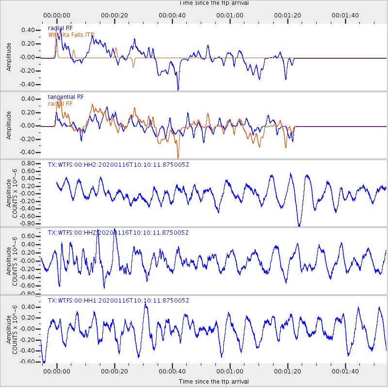
WTFS Witchita Falls - Earthquake Result Viewer
*The percent match for this event was below the threshold and hence no stack was calculated.
| Earthquake location: |
North Of Ascension Island |
| Earthquake latitude/longitude: |
0.1/-17.1 |
| Earthquake time(UTC): |
2020/01/16 (016) 09:58:19 GMT |
| Earthquake Depth: |
10 km |
| Earthquake Magnitude: |
5.5 Mww |
| Earthquake Catalog/Contributor: |
NEIC PDE/us |
|
| Network: |
TX Texas Seismological Network |
| Station: |
WTFS Witchita Falls |
| Lat/Lon: |
33.77 N/98.46 W |
| Elevation: |
277 m |
|
| Distance: |
82.8 deg |
| Az: |
303.878 deg |
| Baz: |
94.706 deg |
| Ray Param: |
$rayparam |
*The percent match for this event was below the threshold and hence was not used in the summary stack. |
|
| Radial Match: |
52.513657 % |
| Radial Bump: |
400 |
| Transverse Match: |
50.512264 % |
| Transverse Bump: |
400 |
| SOD ConfigId: |
20465011 |
| Insert Time: |
2020-01-30 10:10:37.101 +0000 |
| GWidth: |
2.5 |
| Max Bumps: |
400 |
| Tol: |
0.001 |
|
Signal To Noise
| Channel | StoN | STA | LTA |
| TX:WTFS:00:HHZ:20200116T10:10:11.875005Z | 2.0488539 | 2.8222146E-7 | 1.3774601E-7 |
| TX:WTFS:00:HH1:20200116T10:10:11.875005Z | 0.99148047 | 1.6501166E-7 | 1.6642956E-7 |
| TX:WTFS:00:HH2:20200116T10:10:11.875005Z | 1.4294022 | 2.3559865E-7 | 1.6482319E-7 |
| Arrivals |
| Ps | |
| PpPs | |
| PsPs/PpSs | |


