You are here: Home > Network List > PE - Penn State Network Stations List
> Station PAGS PA Geological Survey, Middletown, PA > Earthquake Result Viewer
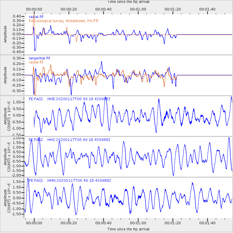
PAGS PA Geological Survey, Middletown, PA - Earthquake Result Viewer
*The percent match for this event was below the threshold and hence no stack was calculated.
| Earthquake location: |
Ascension Island Region |
| Earthquake latitude/longitude: |
-11.6/-13.8 |
| Earthquake time(UTC): |
2020/01/17 (017) 06:37:52 GMT |
| Earthquake Depth: |
10 km |
| Earthquake Magnitude: |
5.9 Mww |
| Earthquake Catalog/Contributor: |
NEIC PDE/us |
|
| Network: |
PE Penn State Network |
| Station: |
PAGS PA Geological Survey, Middletown, PA |
| Lat/Lon: |
40.23 N/76.72 W |
| Elevation: |
120 m |
|
| Distance: |
77.7 deg |
| Az: |
315.761 deg |
| Baz: |
116.779 deg |
| Ray Param: |
$rayparam |
*The percent match for this event was below the threshold and hence was not used in the summary stack. |
|
| Radial Match: |
61.539604 % |
| Radial Bump: |
400 |
| Transverse Match: |
55.26031 % |
| Transverse Bump: |
400 |
| SOD ConfigId: |
20465011 |
| Insert Time: |
2020-01-31 06:46:10.055 +0000 |
| GWidth: |
2.5 |
| Max Bumps: |
400 |
| Tol: |
0.001 |
|
Signal To Noise
| Channel | StoN | STA | LTA |
| PE:PAGS: :HHZ:20200117T06:49:18.439988Z | 1.1490955 | 1.2360277E-6 | 1.0756528E-6 |
| PE:PAGS: :HHN:20200117T06:49:18.439988Z | 0.7136681 | 5.0824343E-7 | 7.121565E-7 |
| PE:PAGS: :HHE:20200117T06:49:18.439988Z | 1.403103 | 6.8080647E-7 | 4.8521485E-7 |
| Arrivals |
| Ps | |
| PpPs | |
| PsPs/PpSs | |


